Link: Skip repetitive navigation links


Crop Explorer User Guide

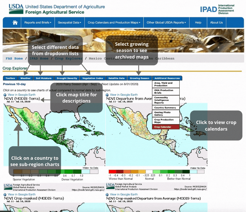
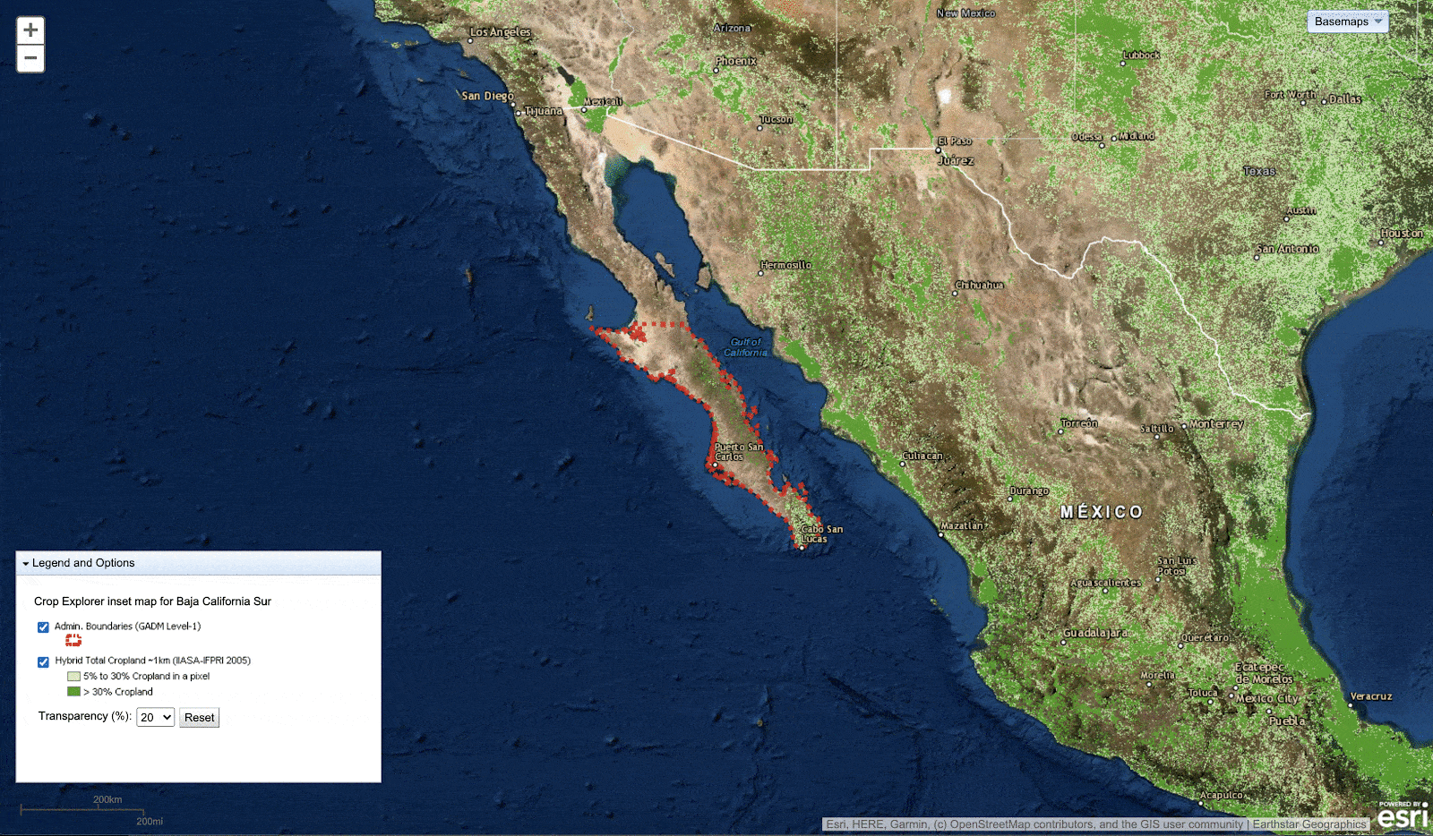
The Crop Explorer Web Site features near-real-time global crop condition information based on satellite imagery and weather data. Thematic maps of major crop growing regions depict vegetative vigor, precipitation, temperature, and soil moisture. Time-series charts depict growing season data for specific agro-meteorological zones. Regional crop calendars and crop area maps are also available for selected regions.

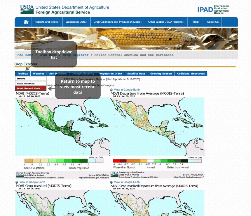
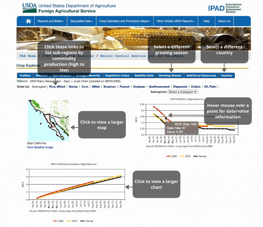
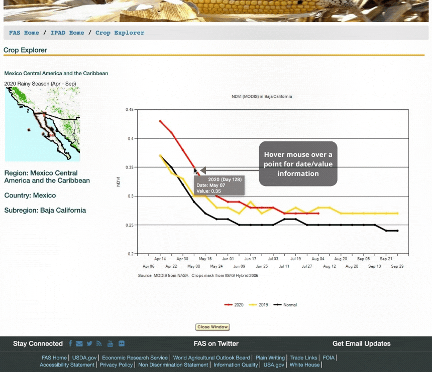
Thematic maps are viewed at the regional level and can be selected for any 10-day period in the current growing season. Previous growing seasons can be selected from the dropdown list for the last two complete years. Historical data is available upon request. Thematic maps are grouped into three categories: Weather; Soil Moisture; and Vegetation Index. Time-series charts depict the same set of data types but for sub-regions that define specific agro-meteorological zones. The subregions are organized by country and in some regions, ranked by commodity production.


Map Data

Top   
After selecting a region from the home page, the first set of thematic maps immediatley appear. From this page you have several options to choose from:
  • Select another data type
  • Select to view an entire or partial growing season
  • Select a country to view their subregion charts
  • Select to view information on the region like their crop calendars and crop area maps
  • Select a to view a data attribute description


Figure 1 - Thematic Maps for Current 10-day Period

Figure 1 - Thematic Maps for Current 10-day Period


Figure 2 - Growing Season Page for Thematic Maps

Figure 2 - Growing Season Page for Thematic Maps


Chart Data

Top   
Time-series charts appear after clicking on a country from the map. The charts or graphs visualize the crop indicator data during the course of the growing season. The charts also pertain to a specific agro-meterological zone defined by Crop Analysts at PECAD. The sub-region chart page has these options:
  • Select another data attribute
  • Select another country within the region. (U.S. states if in the United States)
  • Sort the sub-region charts alphabetically or by crop production
  • View an enlarged image of a chart
  • View sub-region inset maps


Figure 3 - Chart Data (Organized by Country)

Figure 3 - Chart Data (Organized by Country)


Figure 4 - Chart Data (Enlarged Chart)

Figure 4 - Chart Data (Enlarged Chart)


Figure 5 - Chart Data (Pop-up window with larger insert map)

Figure 5 - Chart Data (Pop-up window with larger insert map)

Top
Link: Skip repetitive navigation links