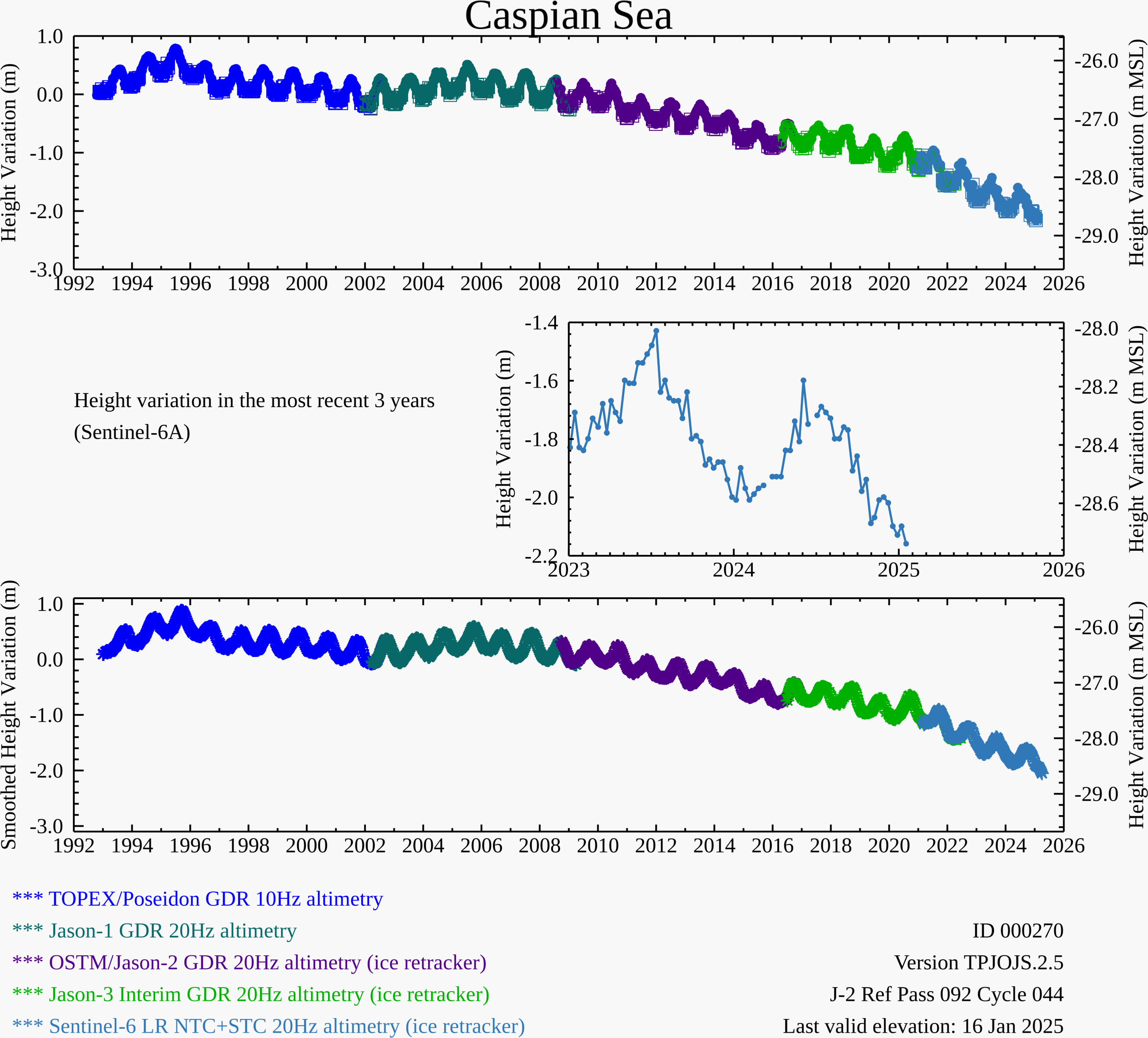
Right click on the graph or graph title to save the time series image. Left click on the top graph to download the time series text files.
Shown above are relative lake height variations computed from satellite radar altimetry data sets. These will be based on the TOPEX/Poseidon/Jason/Sentinel-6 satellite series (at 10-day resolution), the SWOT mission (21-day resolution), the Sentinel-3 series (at 27-day resolution), and the ERS/ENVISAT/SARAL series (at 35-day resolution). For all of these relative height products the datum is based on an elevation profile on one satellite overpass date and each time series will be derived from a combination of near real time and archive data. The top graph reveals variations based on a minimum level of filtering with open circle symbols used to denote potential calm water or icy conditions. The bottom graph are results from a smoothing/filtering function that aims to reduce outliers and reduce high frequency noise. This smoothed time series is a visualization aid only.
The project team acknowledges NASA PO.DAAC, NOAA, AVISO, and TU-Delft for the provision of the NASA, ESA, CNES and ISRO satellite data sets and for access to the RADS database.
|