IPAD
International
Production
Assessment
Division
Toggle navigation
Reports and Briefs
Commodity Intelligence Reports (CIR)
World Agricultural Production (WAP) Circulars
Country Summary
Crop Calendars and Production Maps
Crop Calendars
Crop Production Maps
Monthly Crop Stage and Harvest Calendars
Monthly Production and Trade Maps
Geospatial Data
Crop Explorer
Commodity Explorer
Global Agricultural Monitoring (GLAM)
Global Reservoirs and Lakes Monitor (G-REALM)
Global Agricultural & Disaster Assesment System (GADAS)
Geotag Photo Gallery
Tropical Cyclone Monitor Maps
Automated Flooded Cropland Area Maps (AFCAM)
WMO Station Explorer
Tropical Cyclone Monitor
Other Global USDA Reports
World Agricultural Supply and Demand Estimates (WASDE)
USDA Weekly Weather and Crop Bulletin (NASS/WAOB)
PSD Online
FAS Attache GAIN Reports
PS&D Market and Trade Data
Help
About Us
FAS Home
/
IPAD Home
/
Crop Production Maps
East Africa - Crop Production Maps
Ethiopia
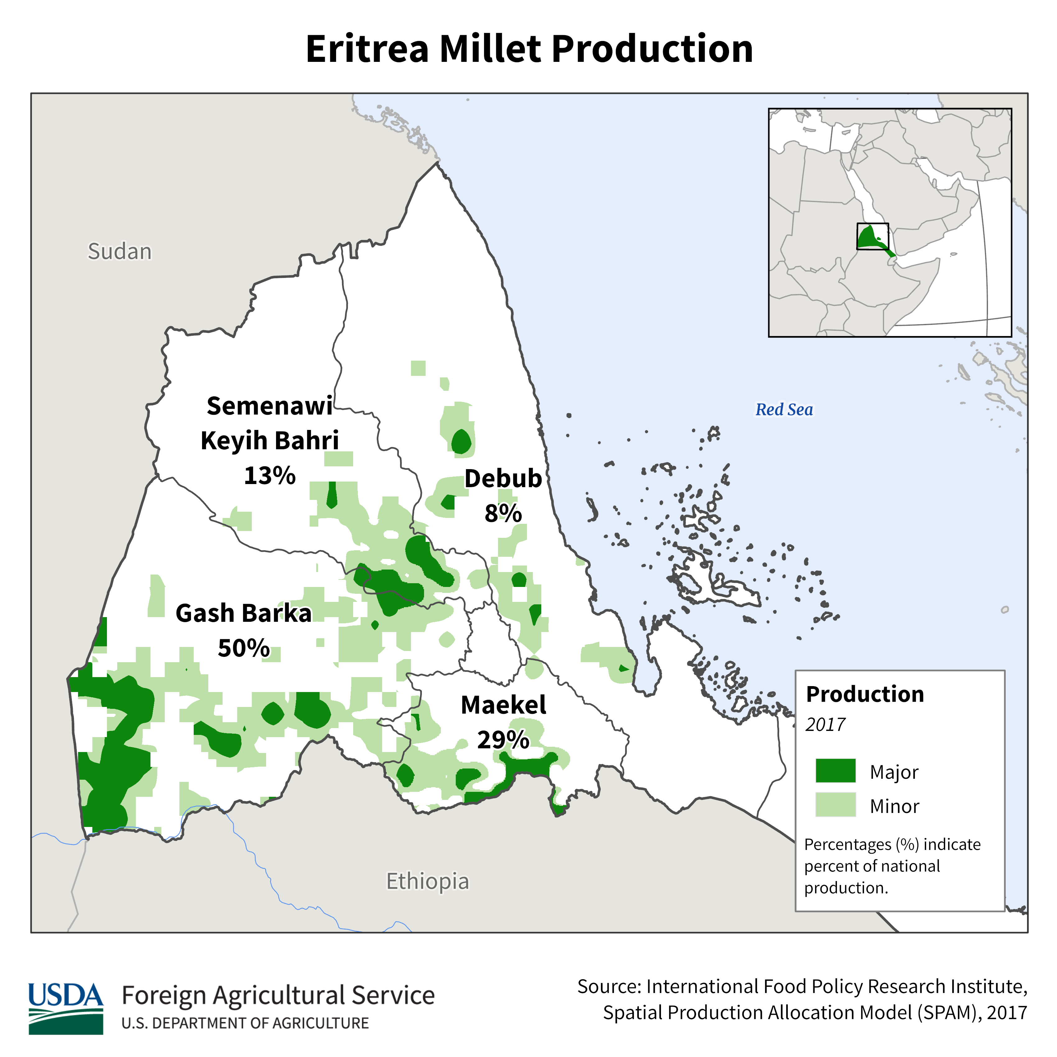
Eritrea
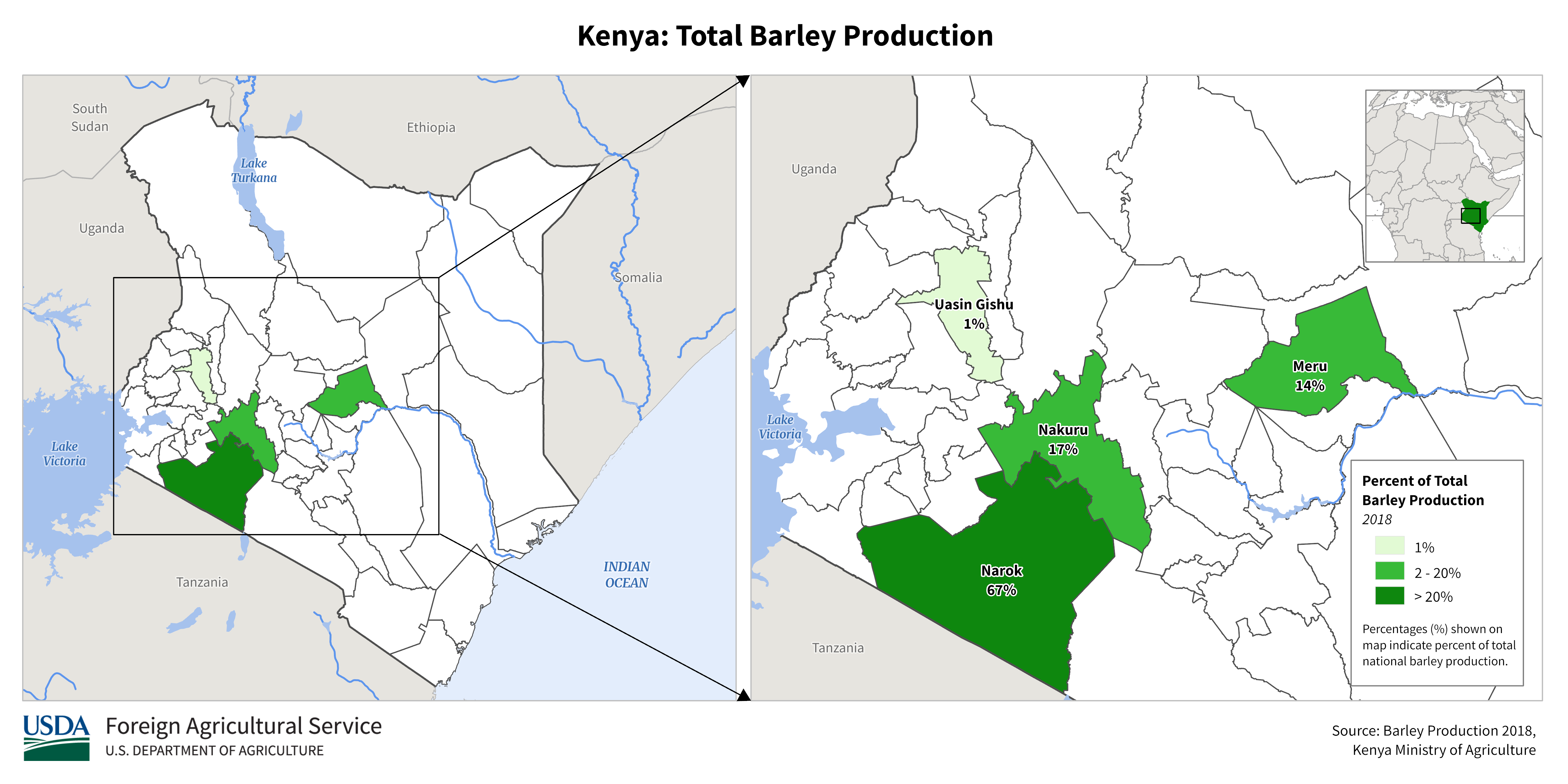
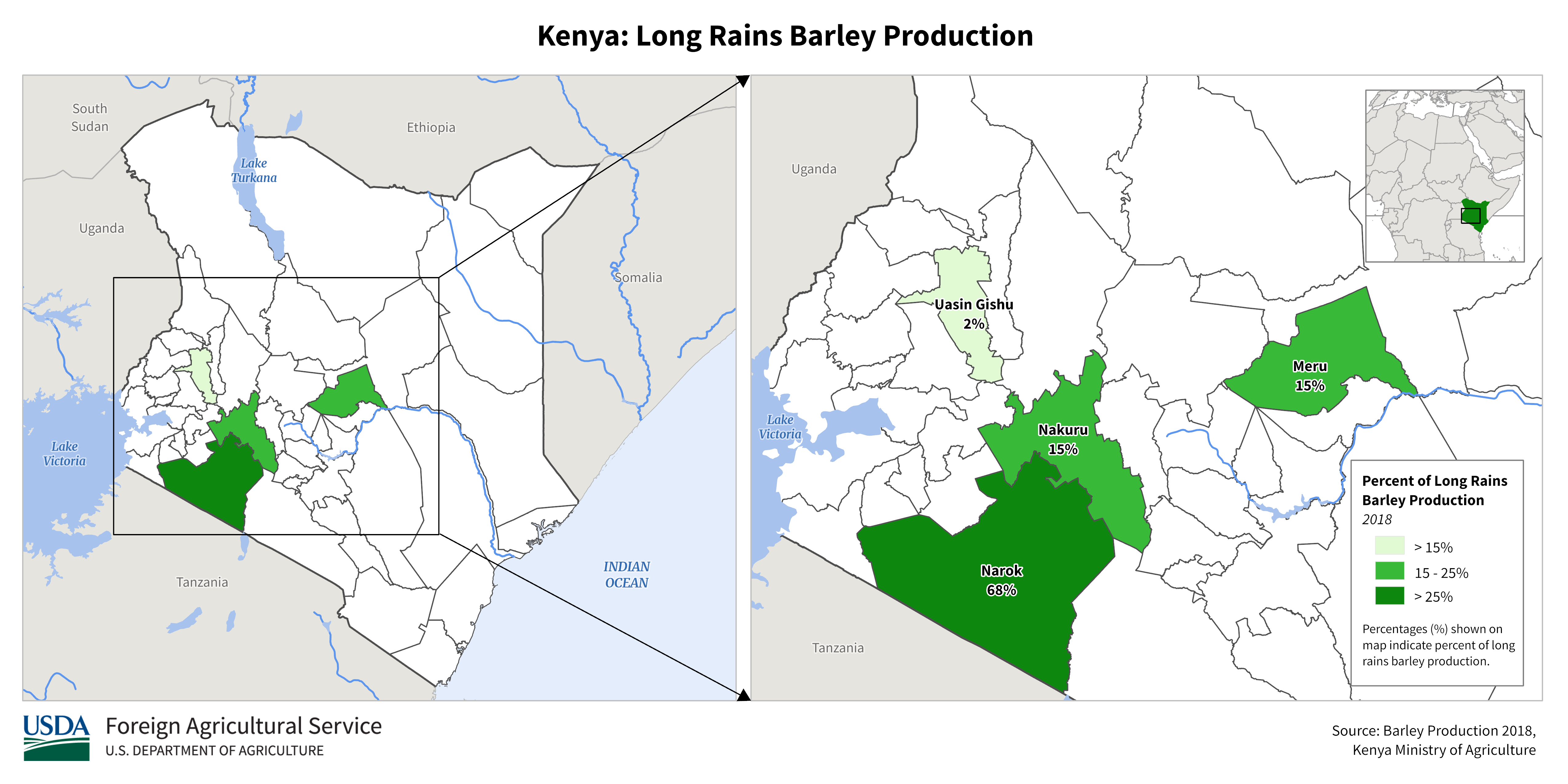
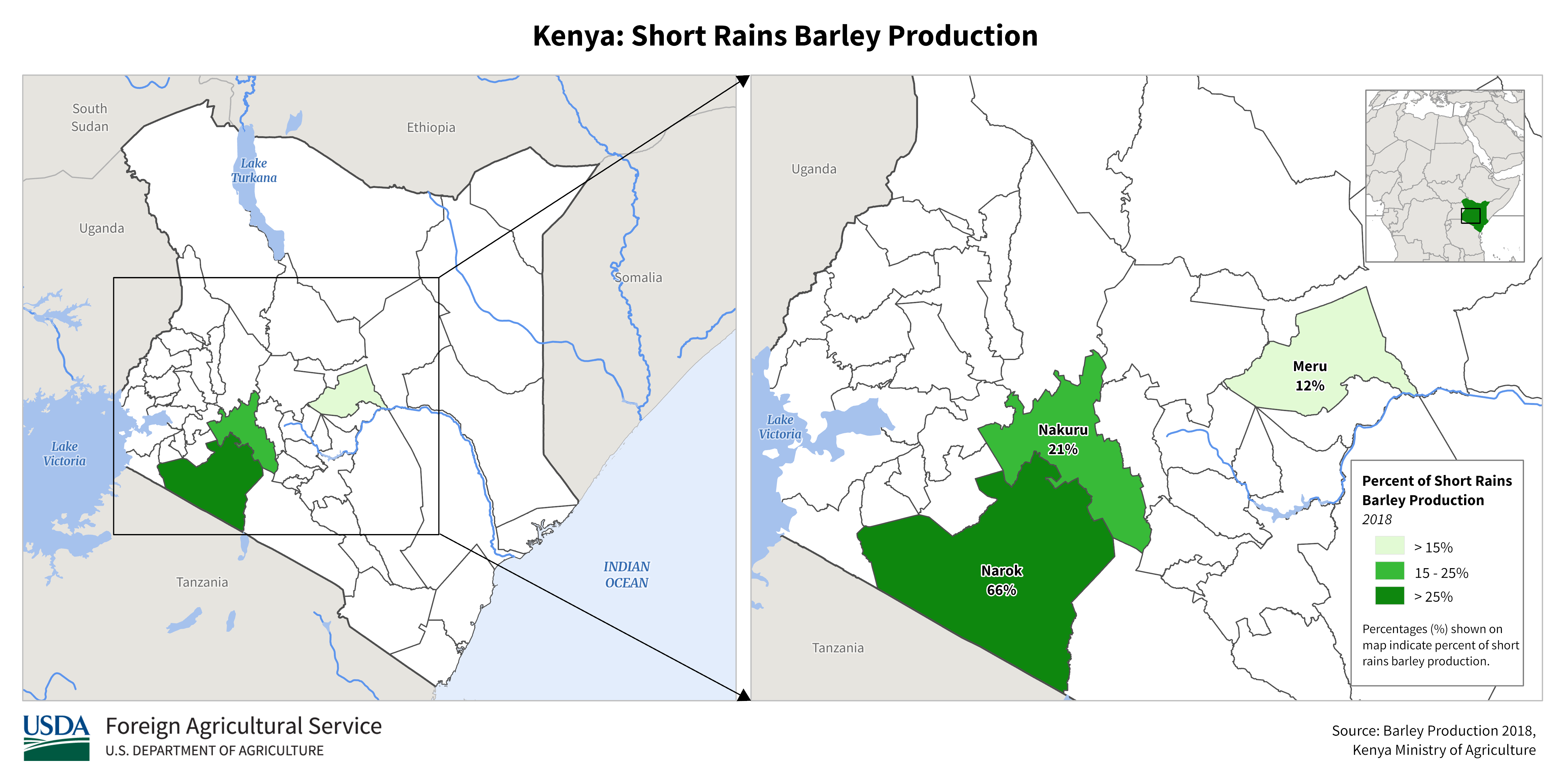
Kenya
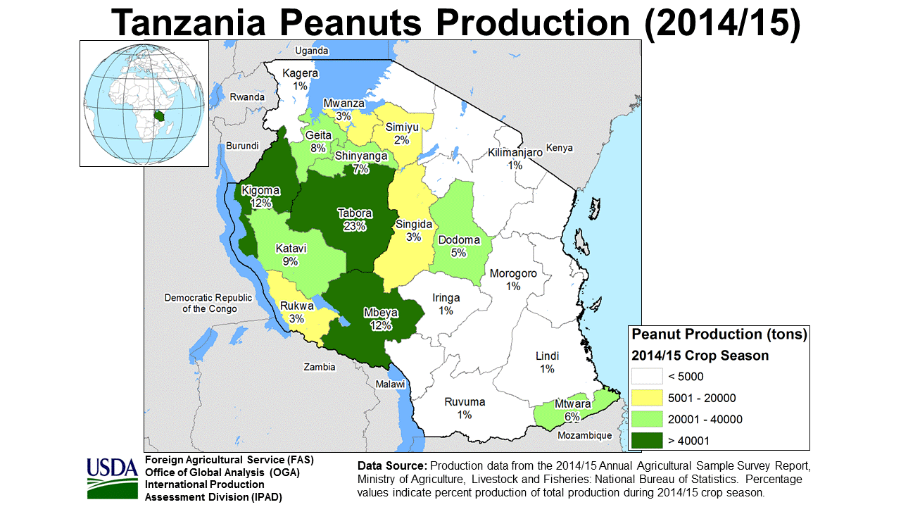
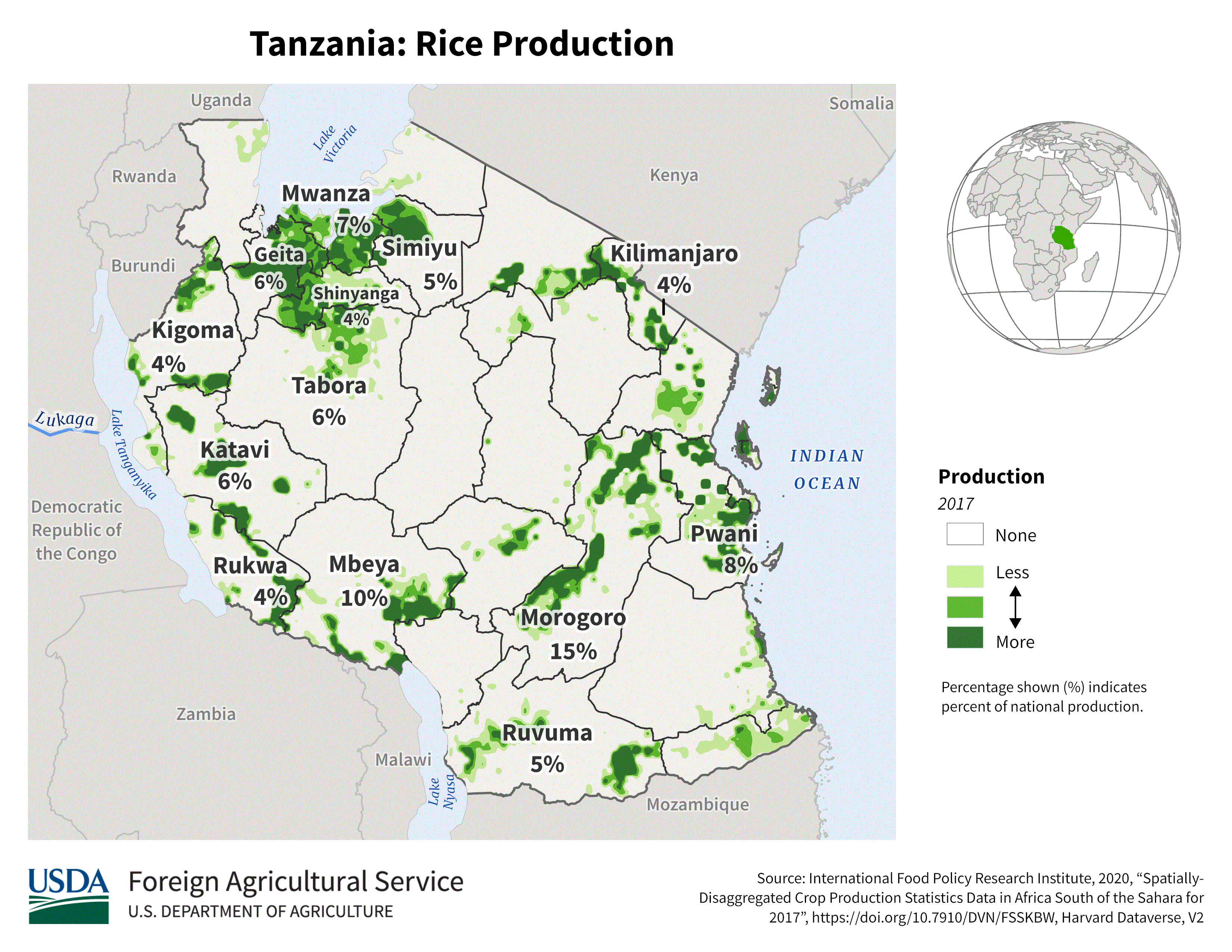
Tanzania
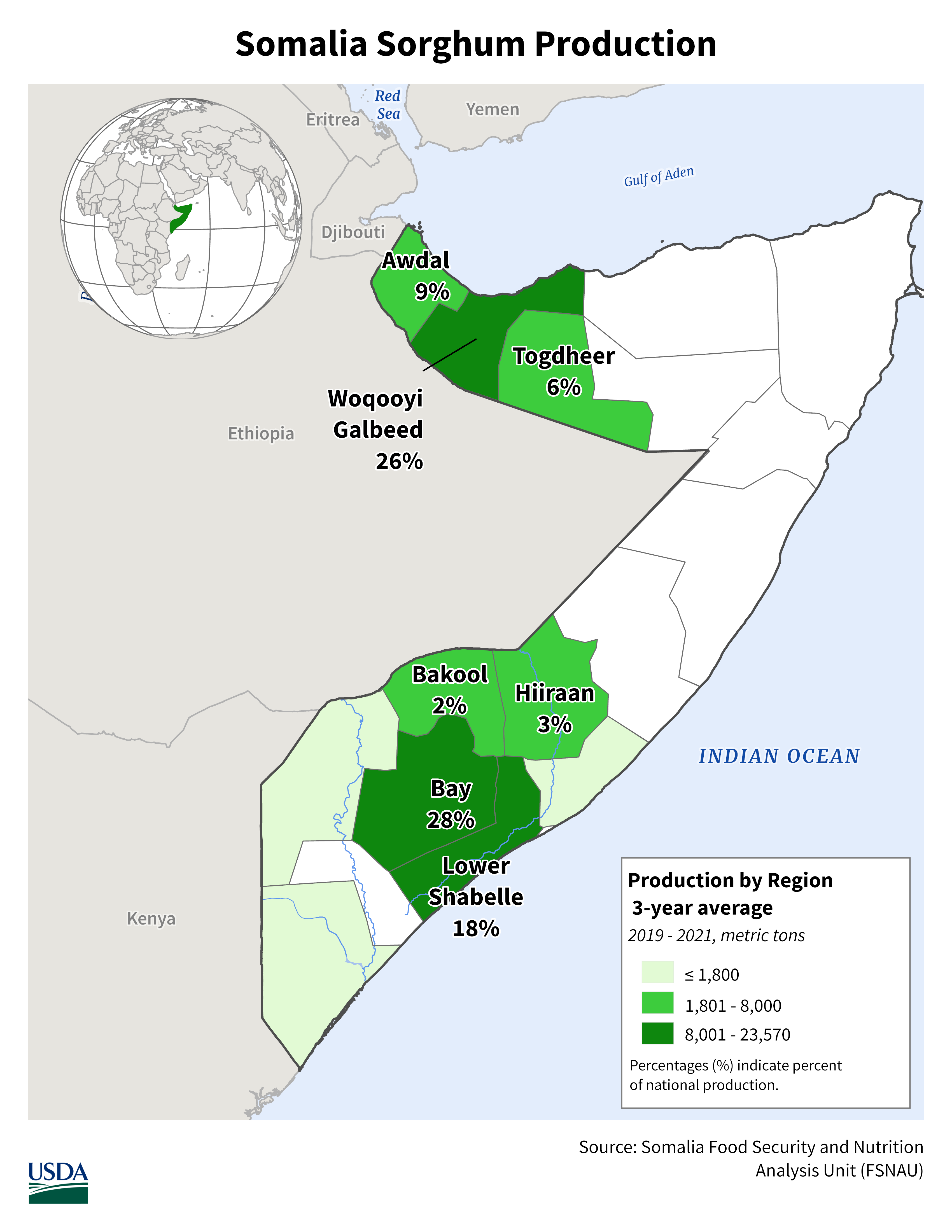
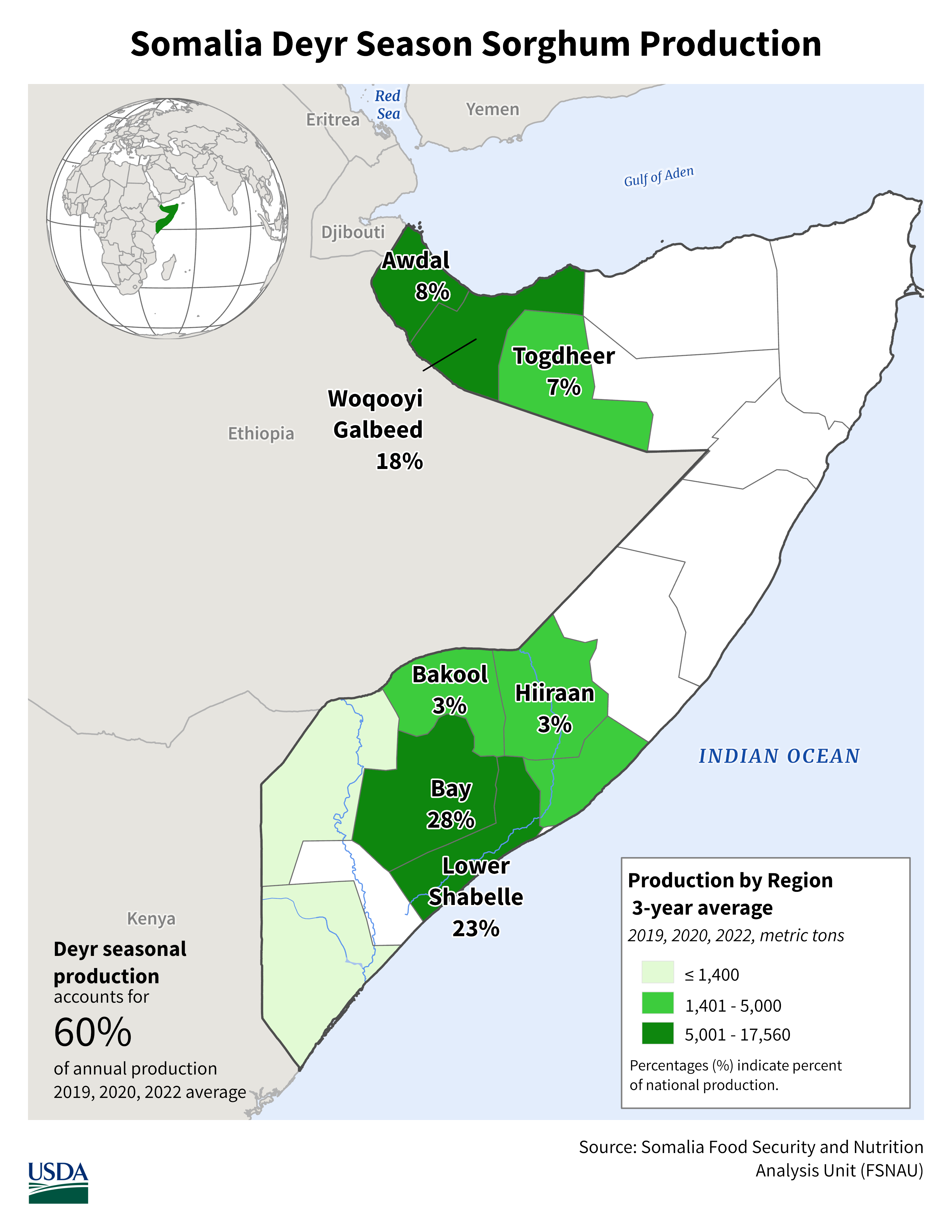
Somalia
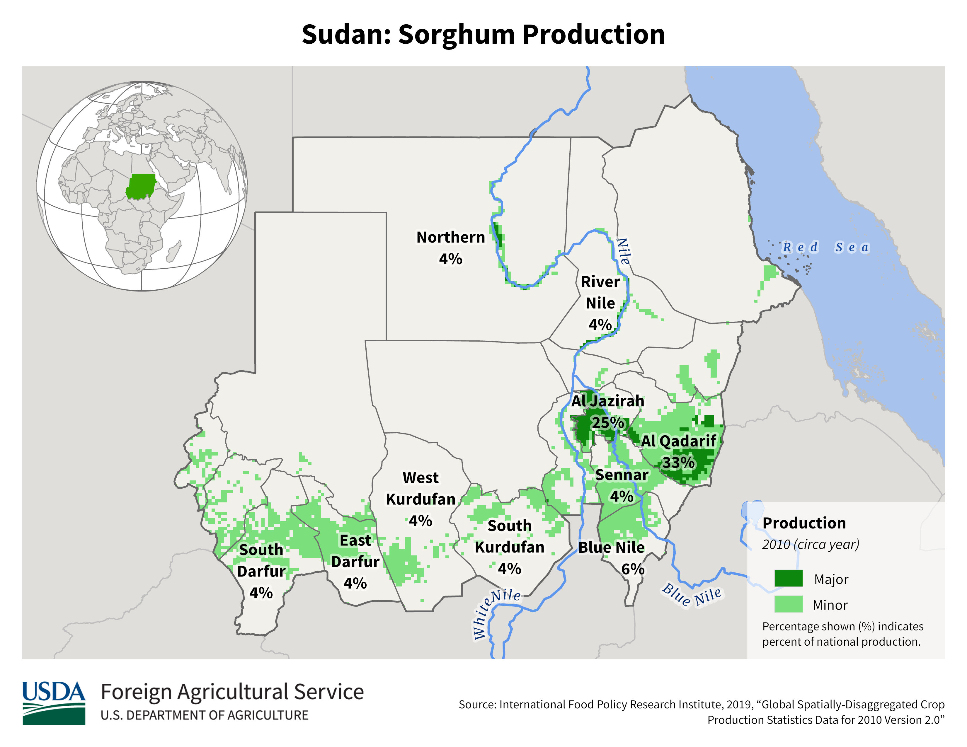
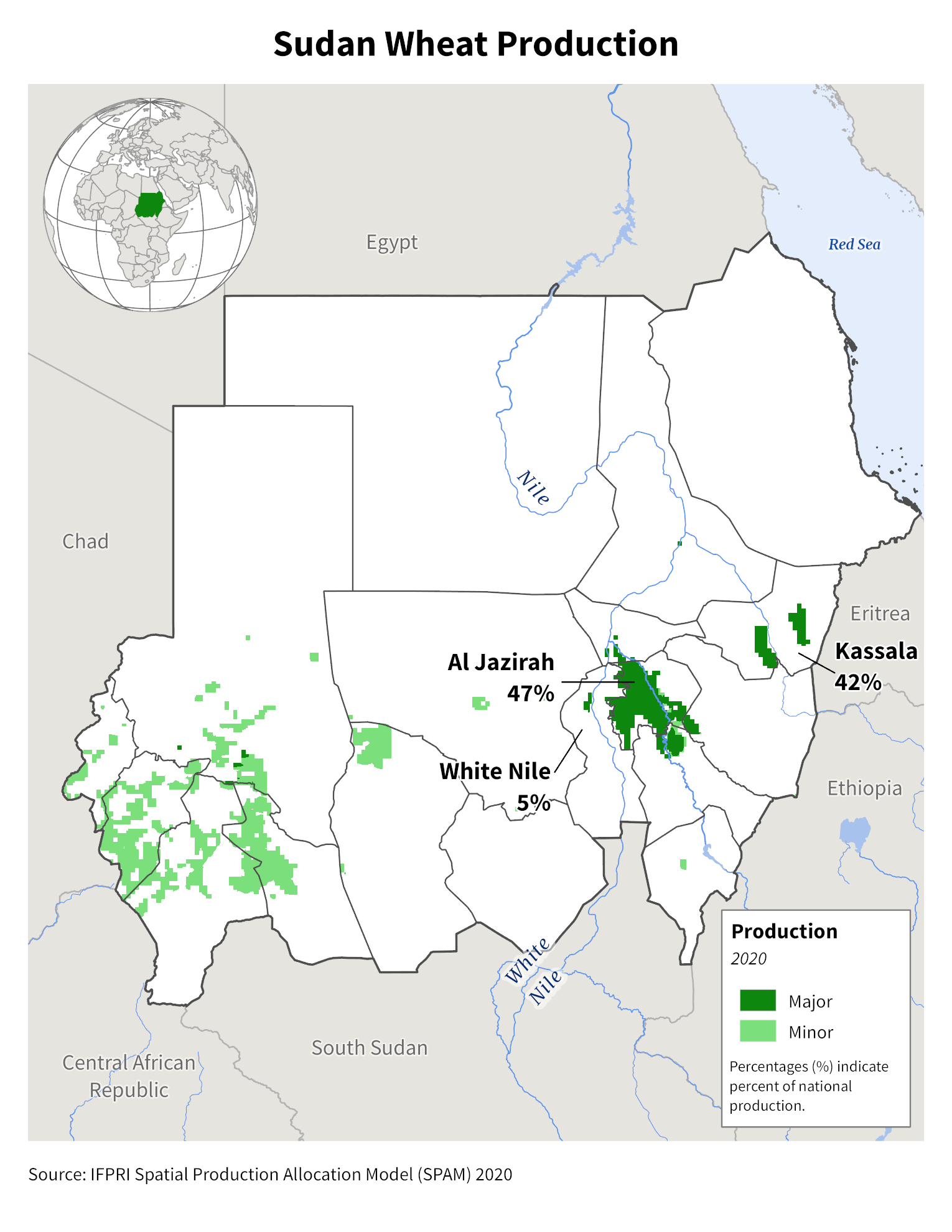
Sudan
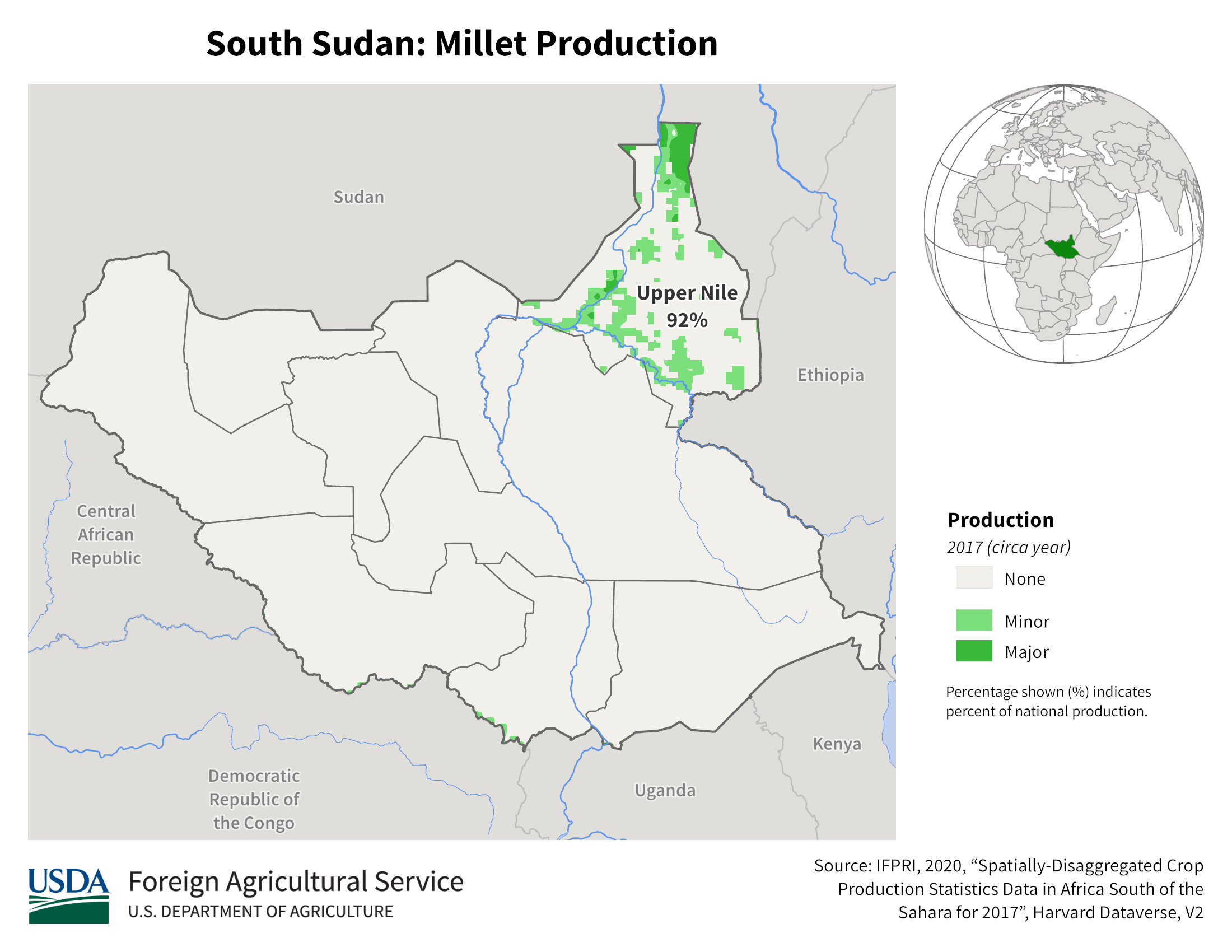
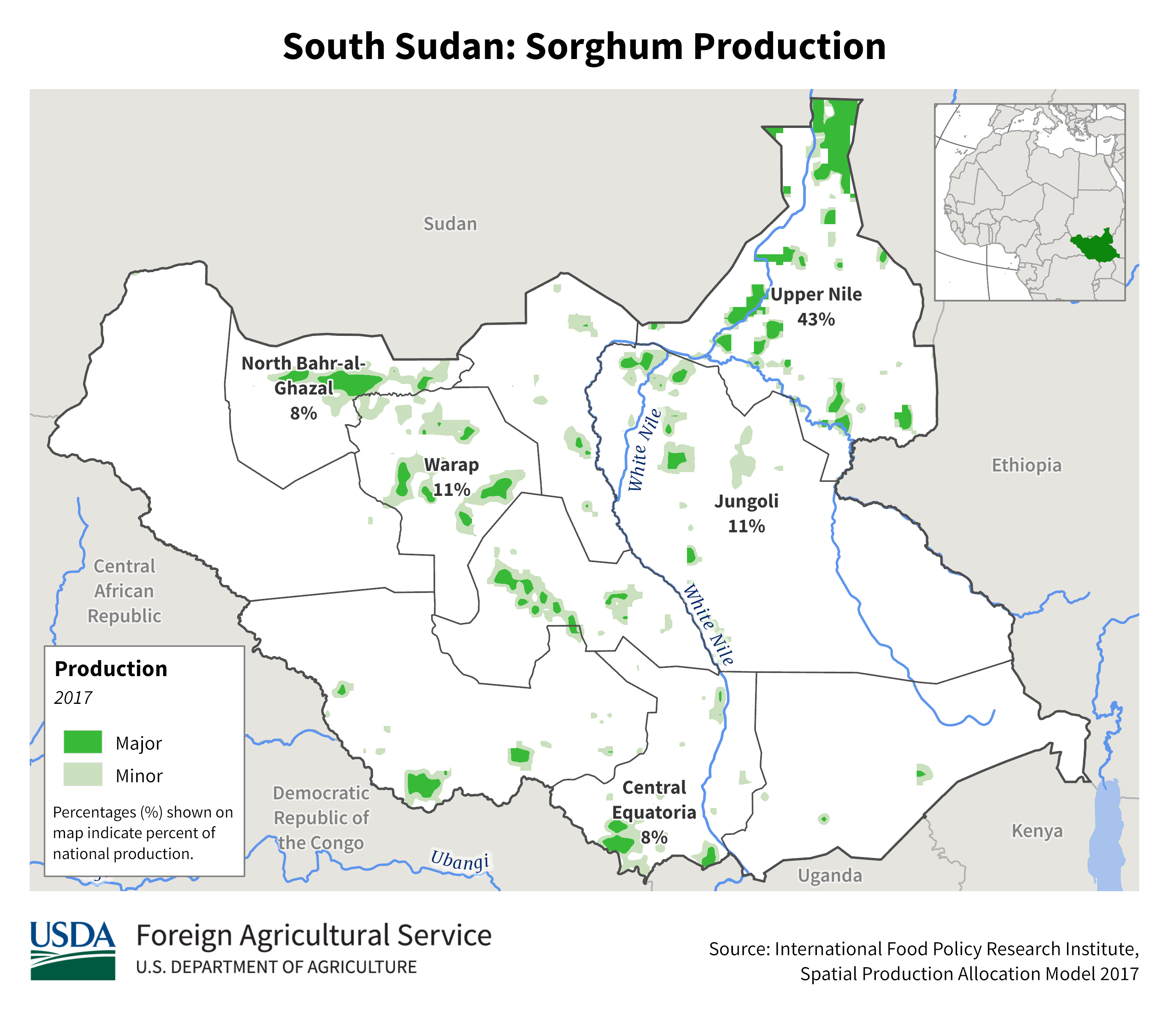
South Sudan
Rwanda
Uganda
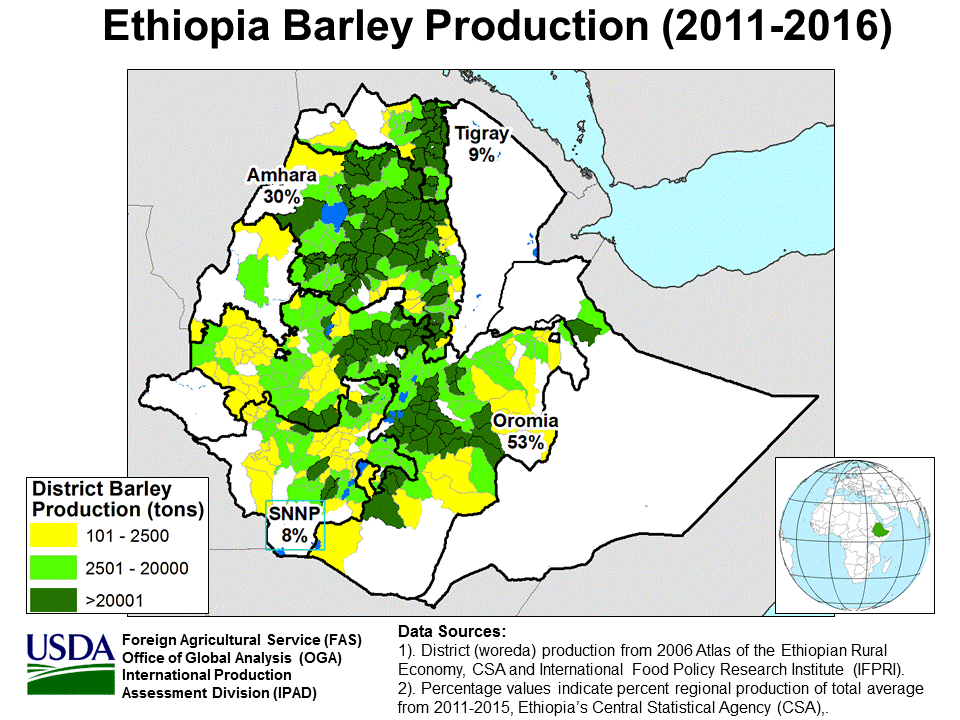
Barley
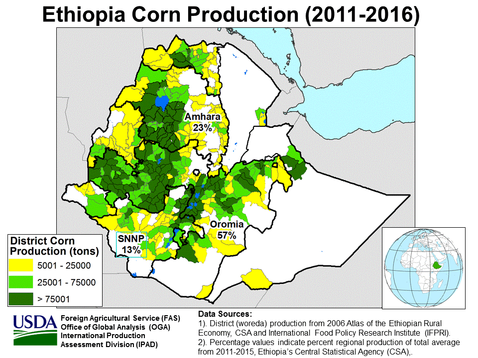
Corn
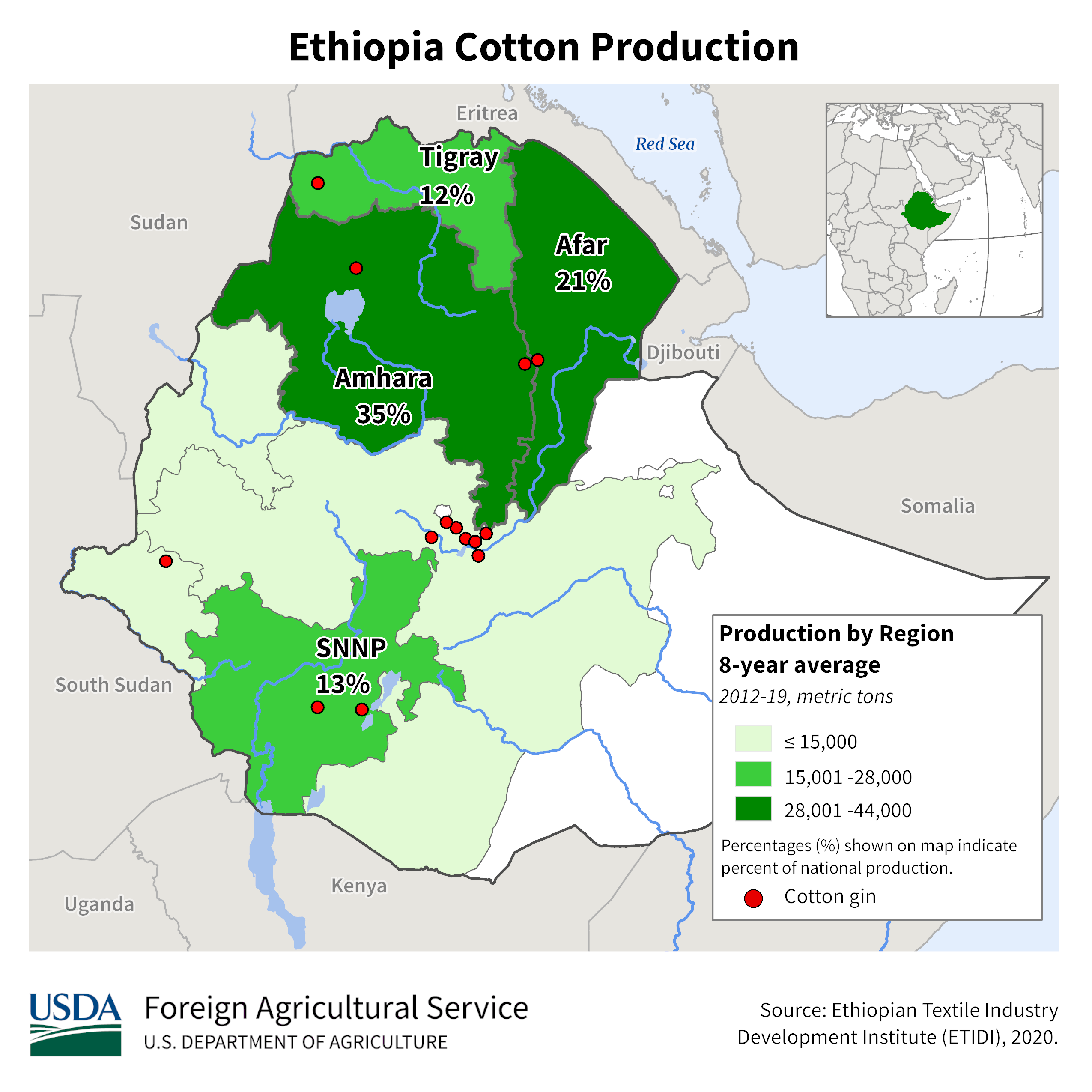
Cotton
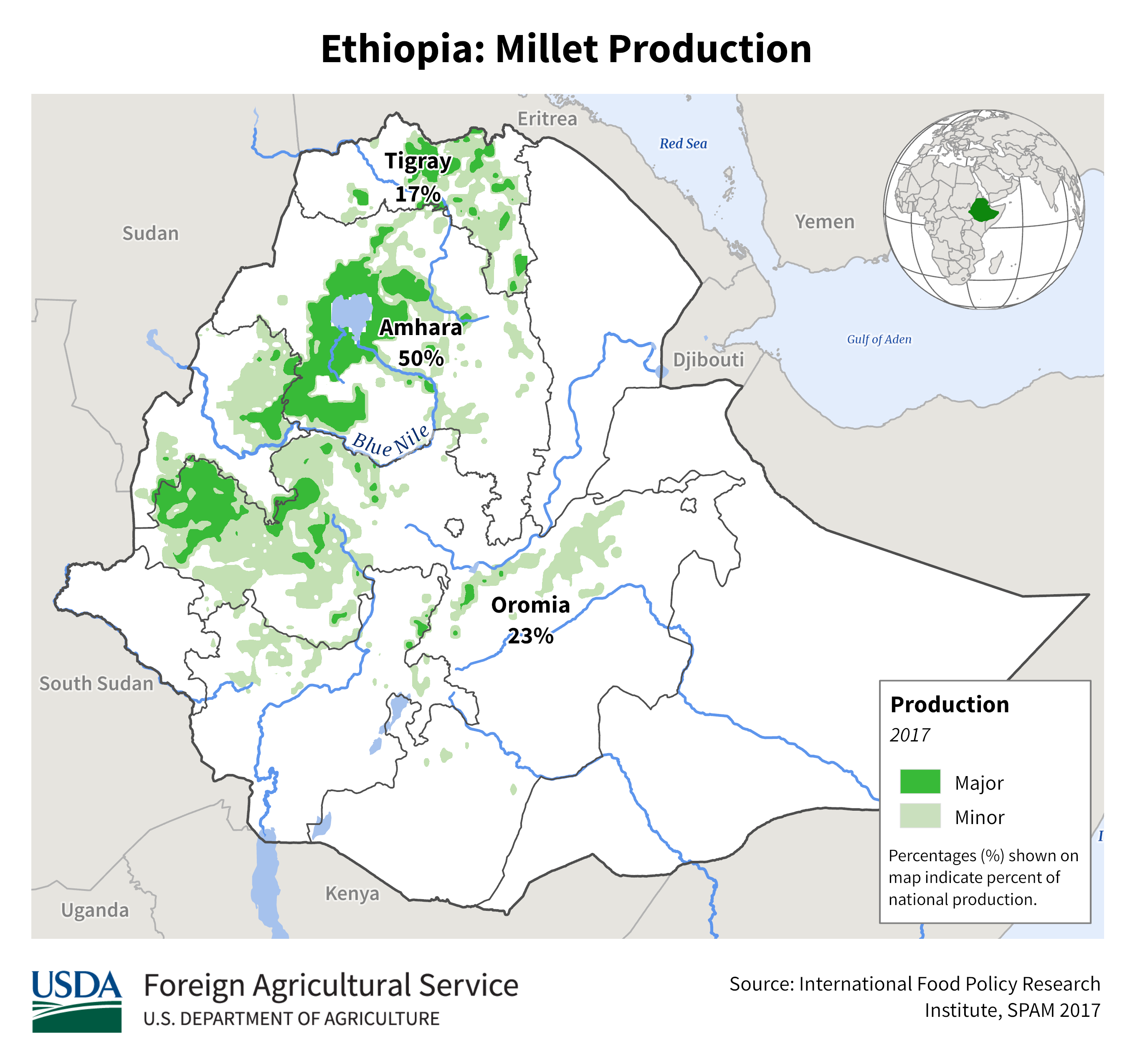
Millet
Rapeseed
Sorghum
Soybean
Wheat
Sorghum
Millet
Barley
Barley
Long Rains
Barley
Short Rains
Corn
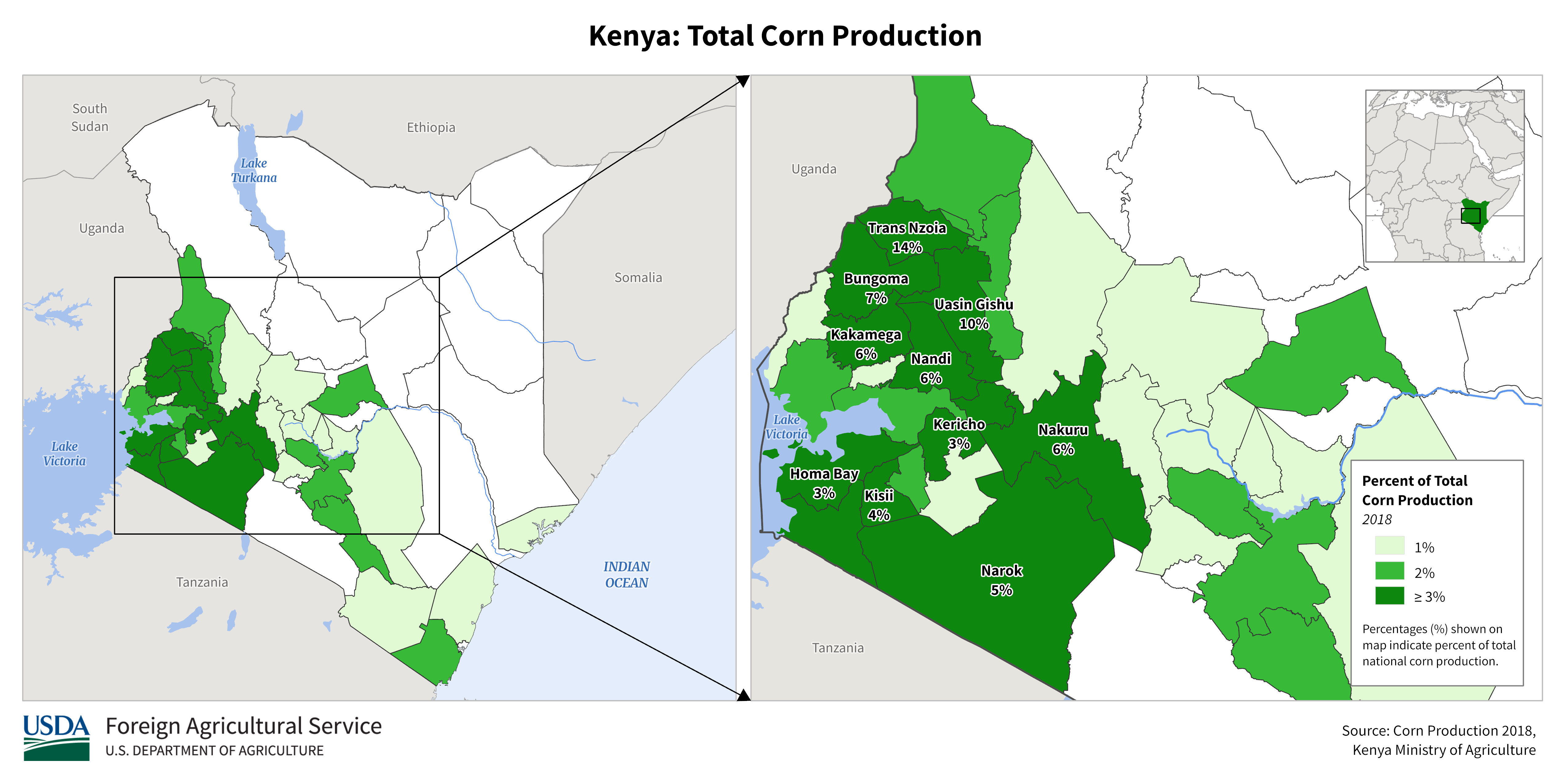
Corn
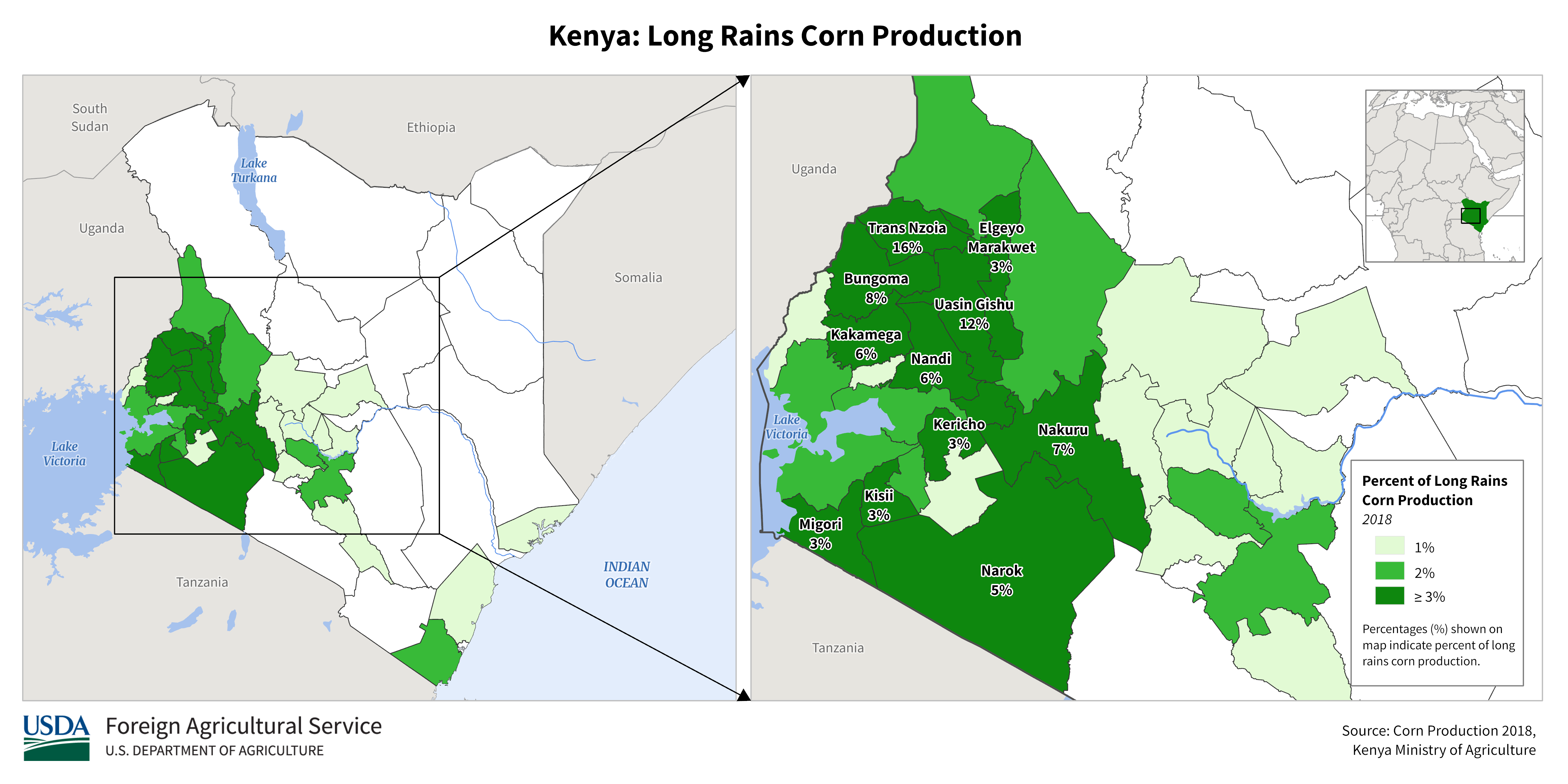
Long Rains
Corn
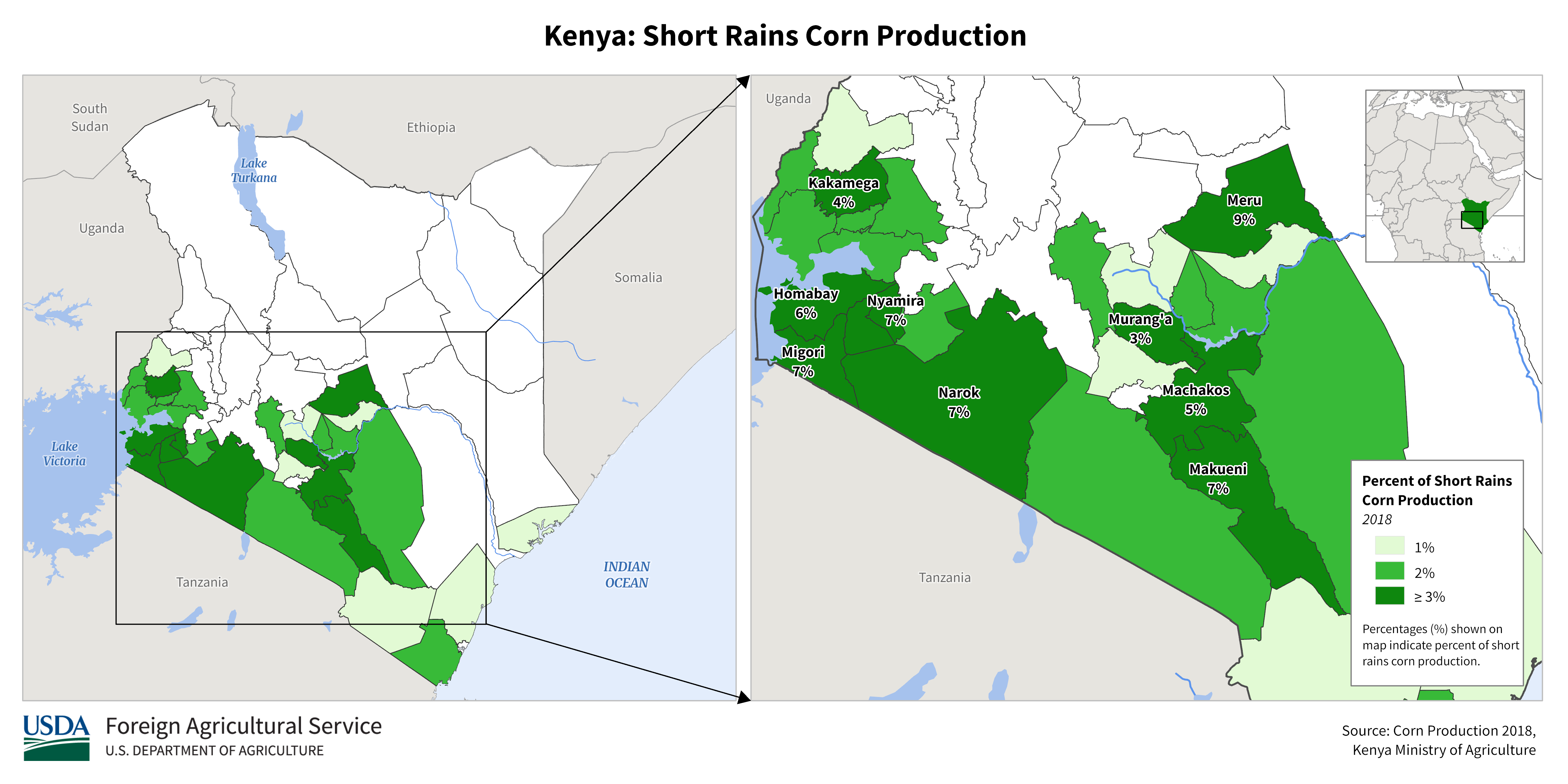
Short Rains
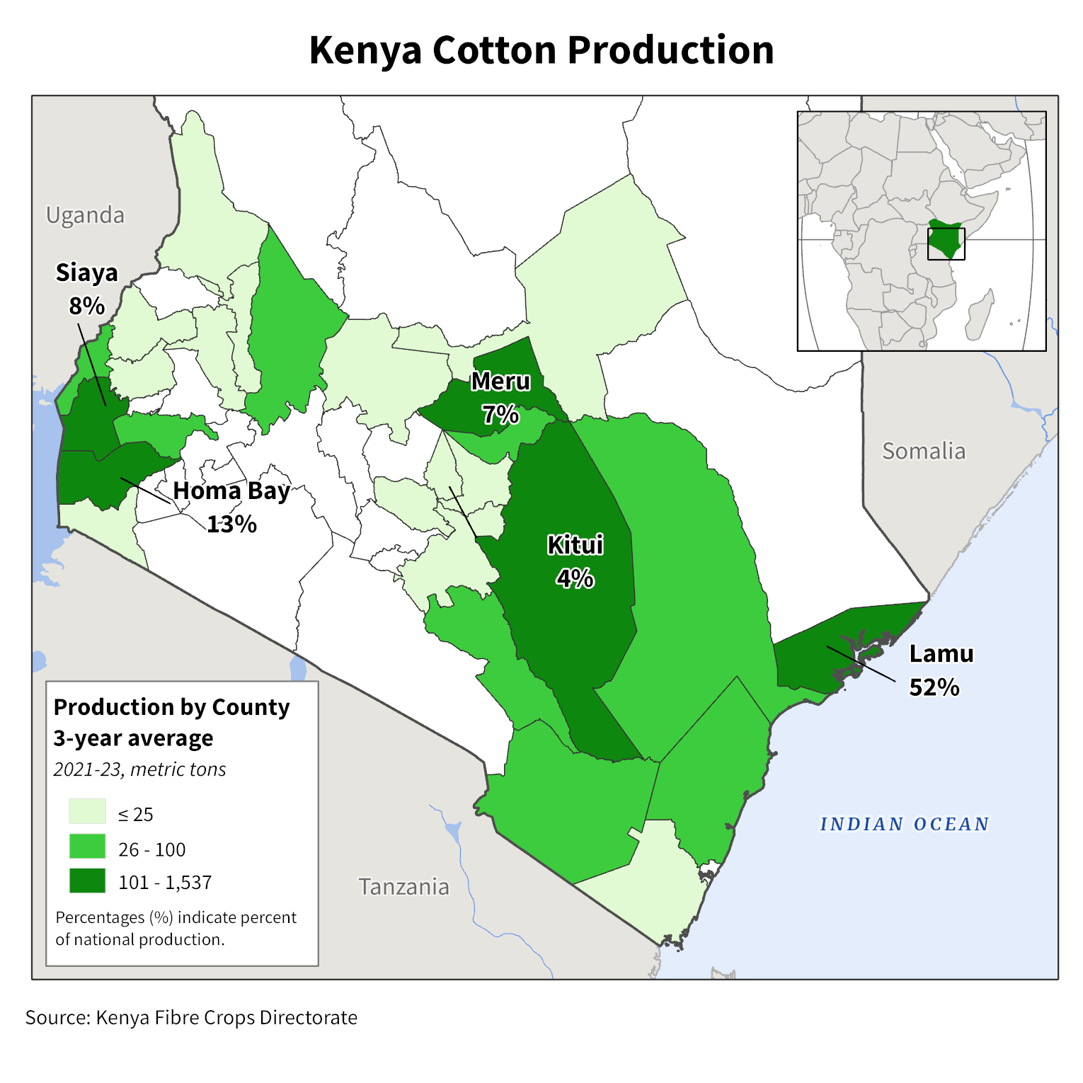
Cotton
Millet
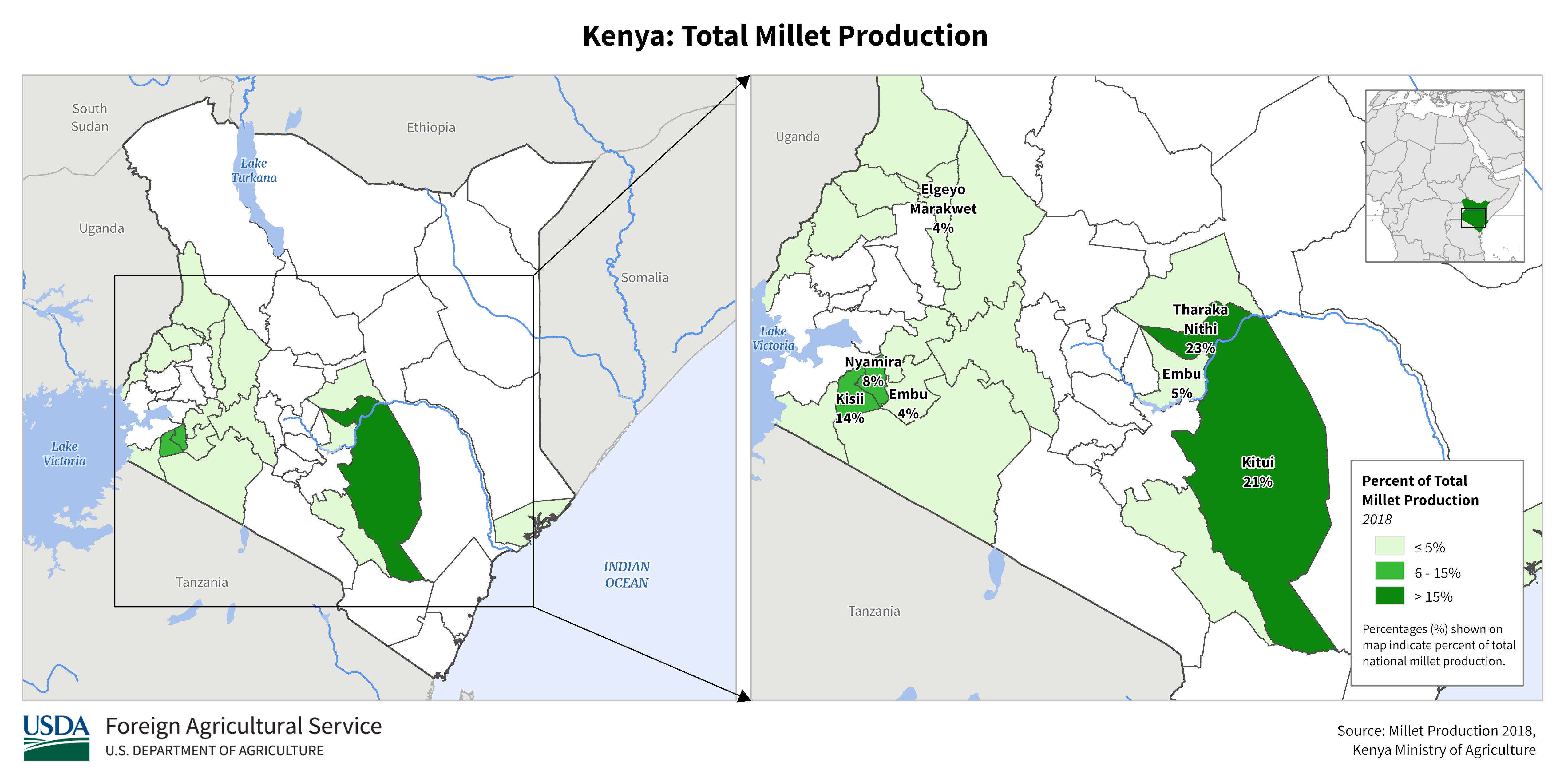
Millet
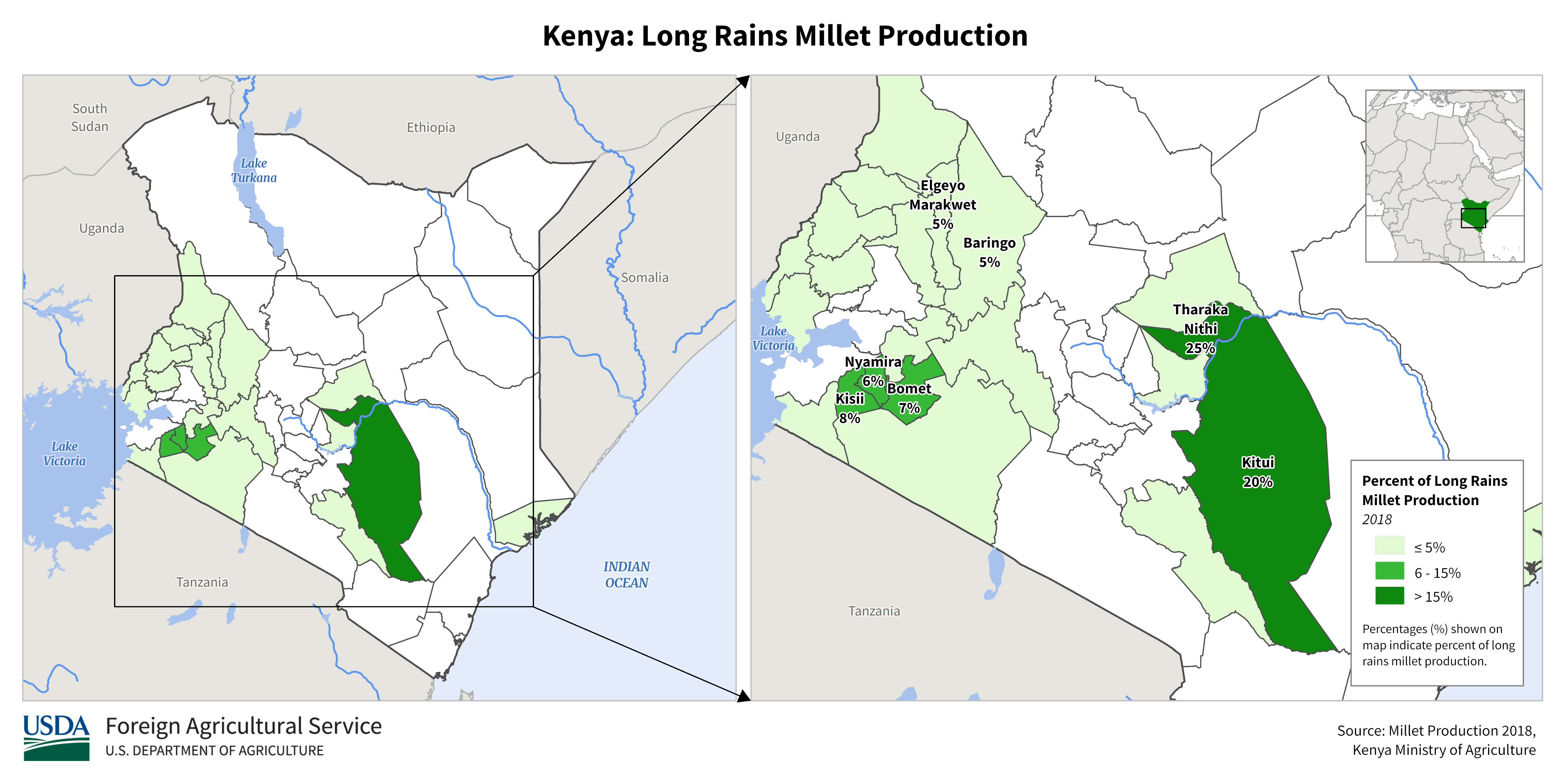
Long Rains
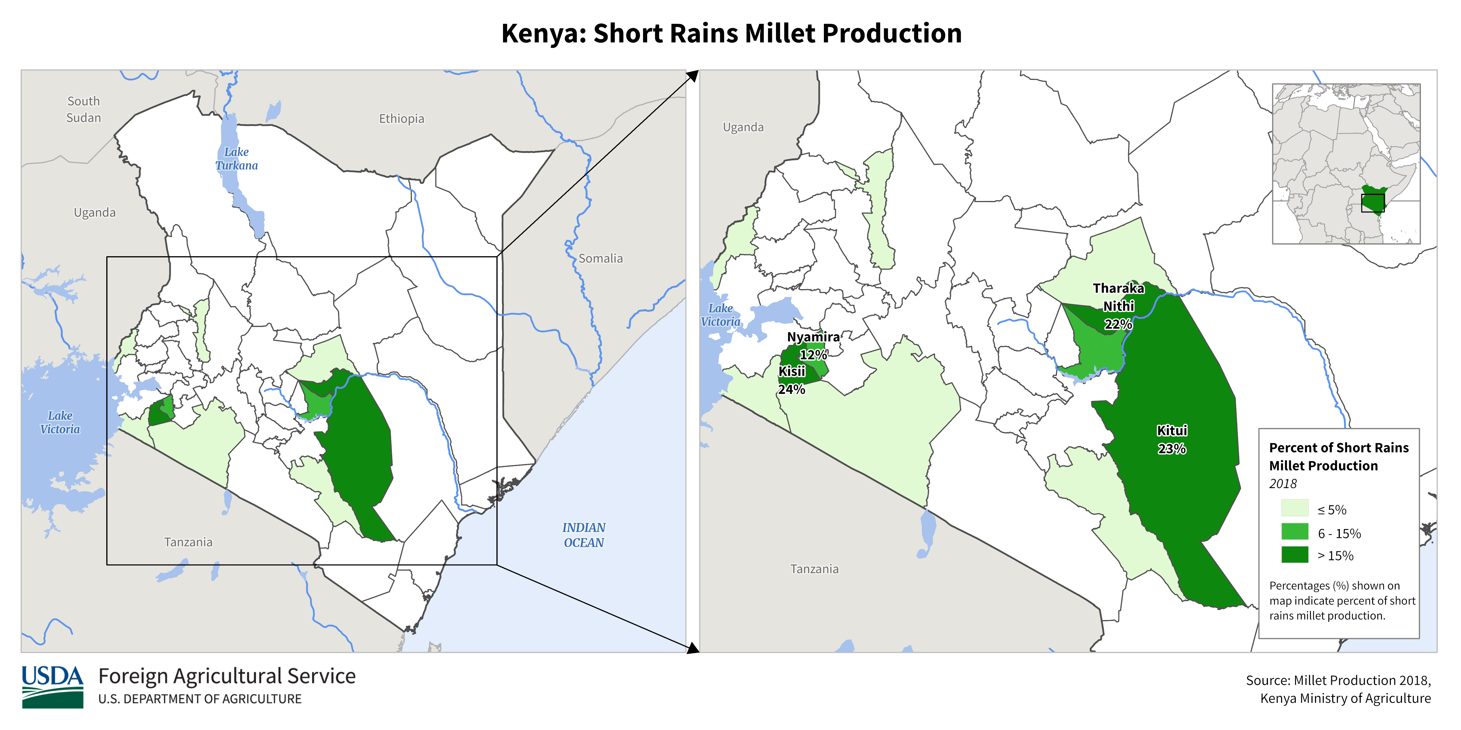
Millet
Short Rains
Rice
Sorghum
Sorghum
Long Rains
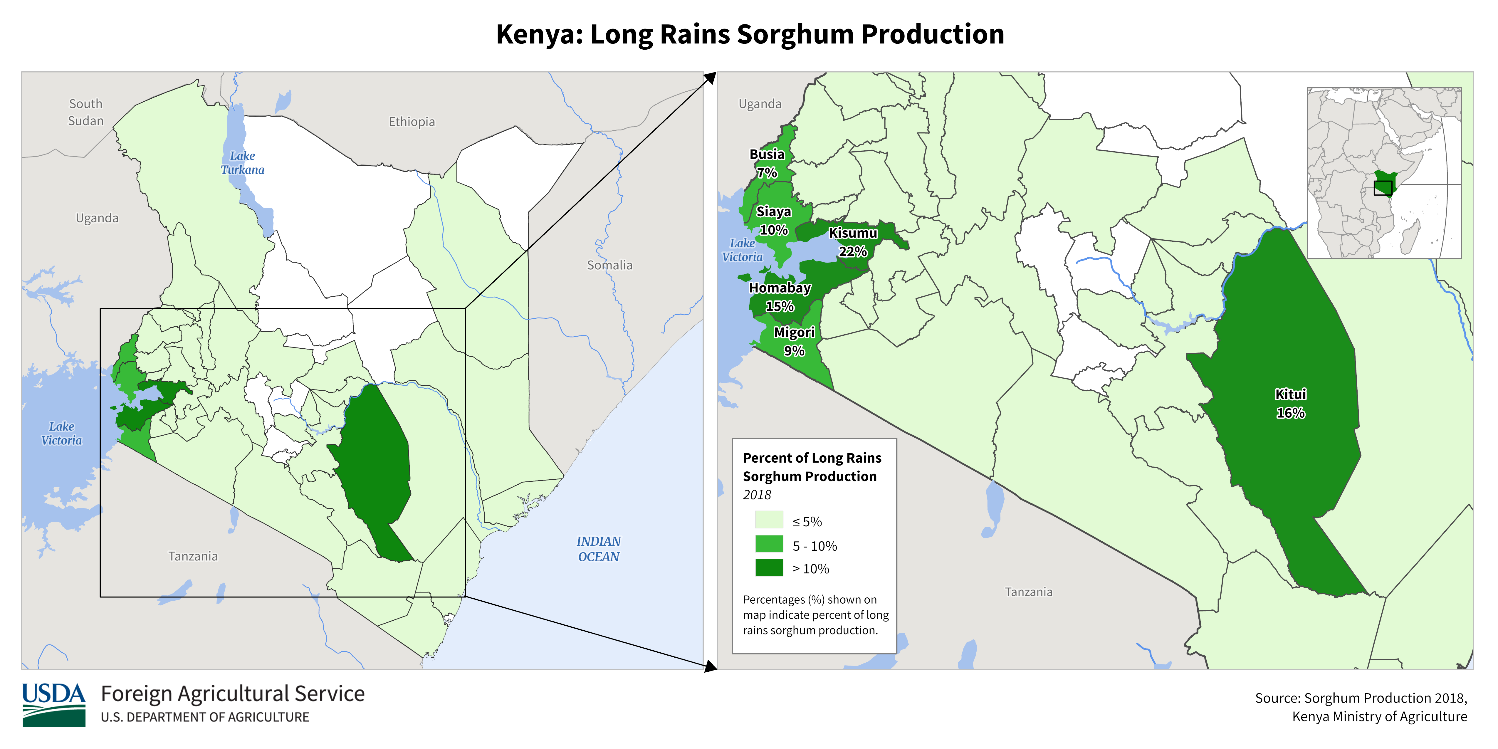
Sorghum
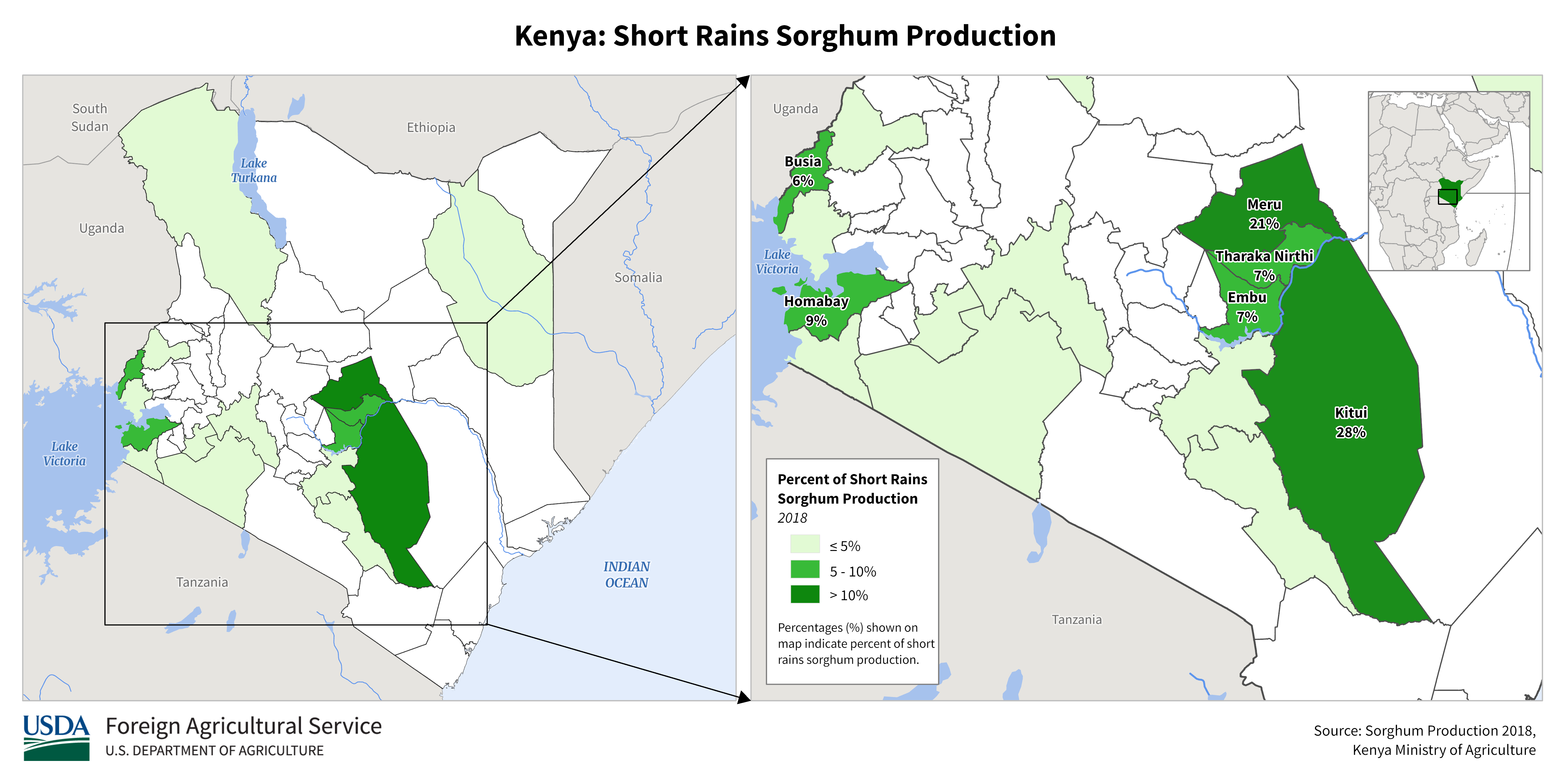
Short Rains
Wheat
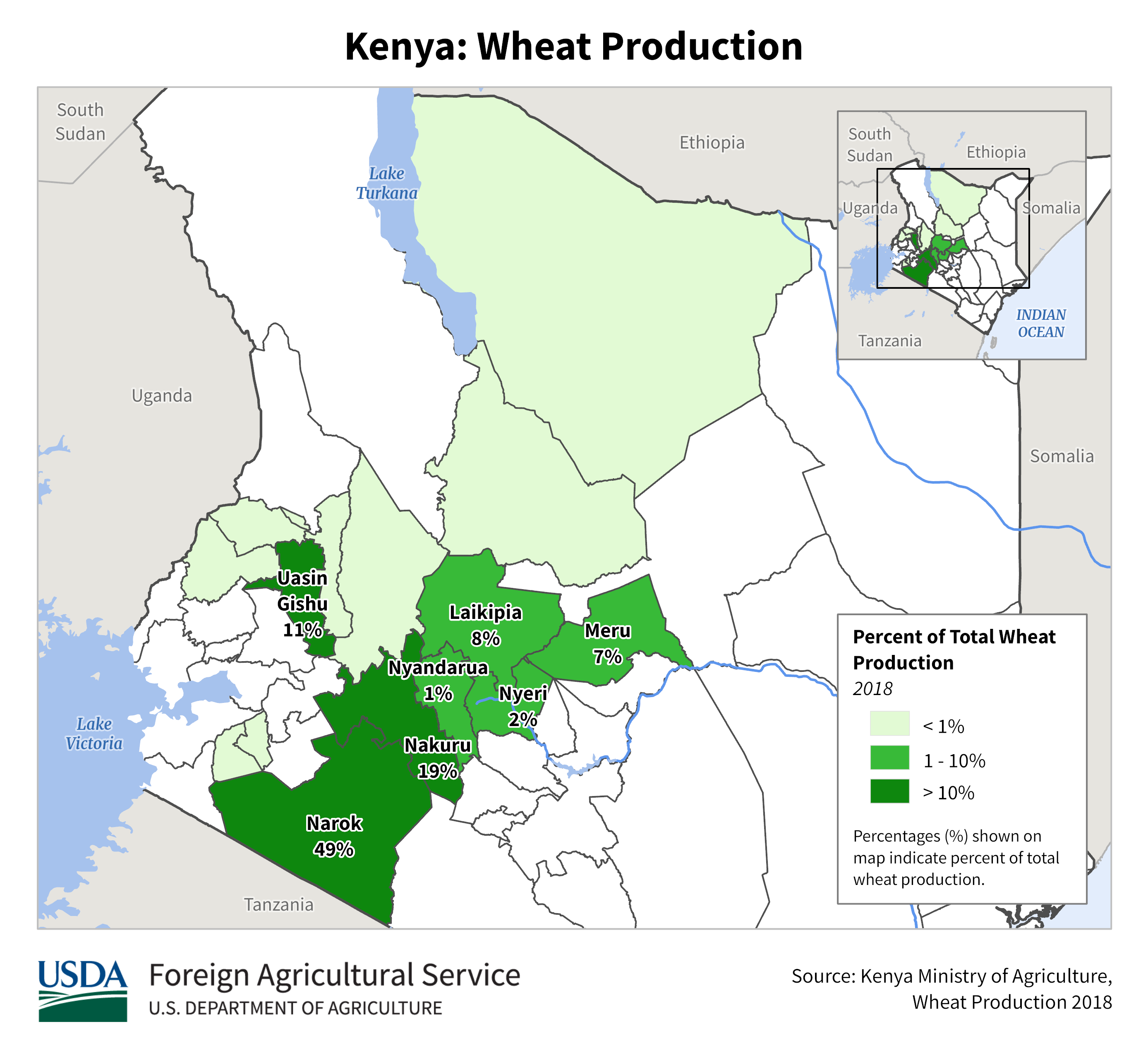
Wheat
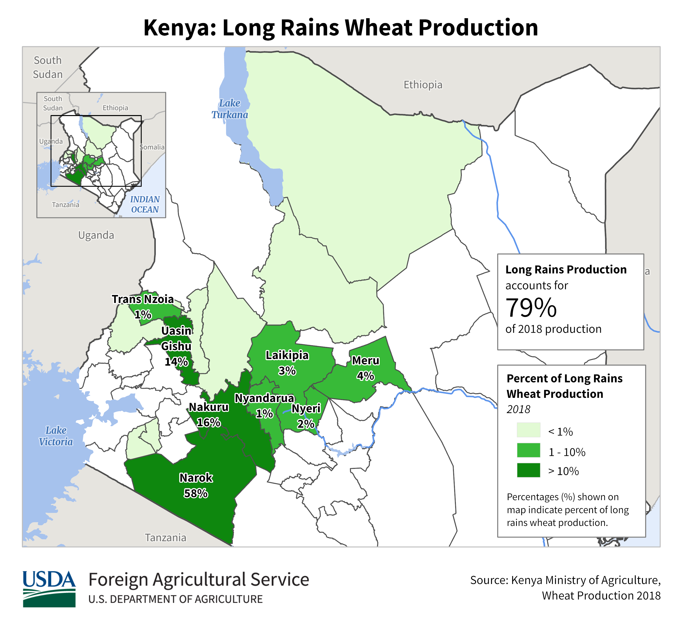
Long Rains
Wheat
Short Rains
Corn
Cotton
Millet
Peanut
Sorghum
Rice
Sorghum
Deyr Sorghum
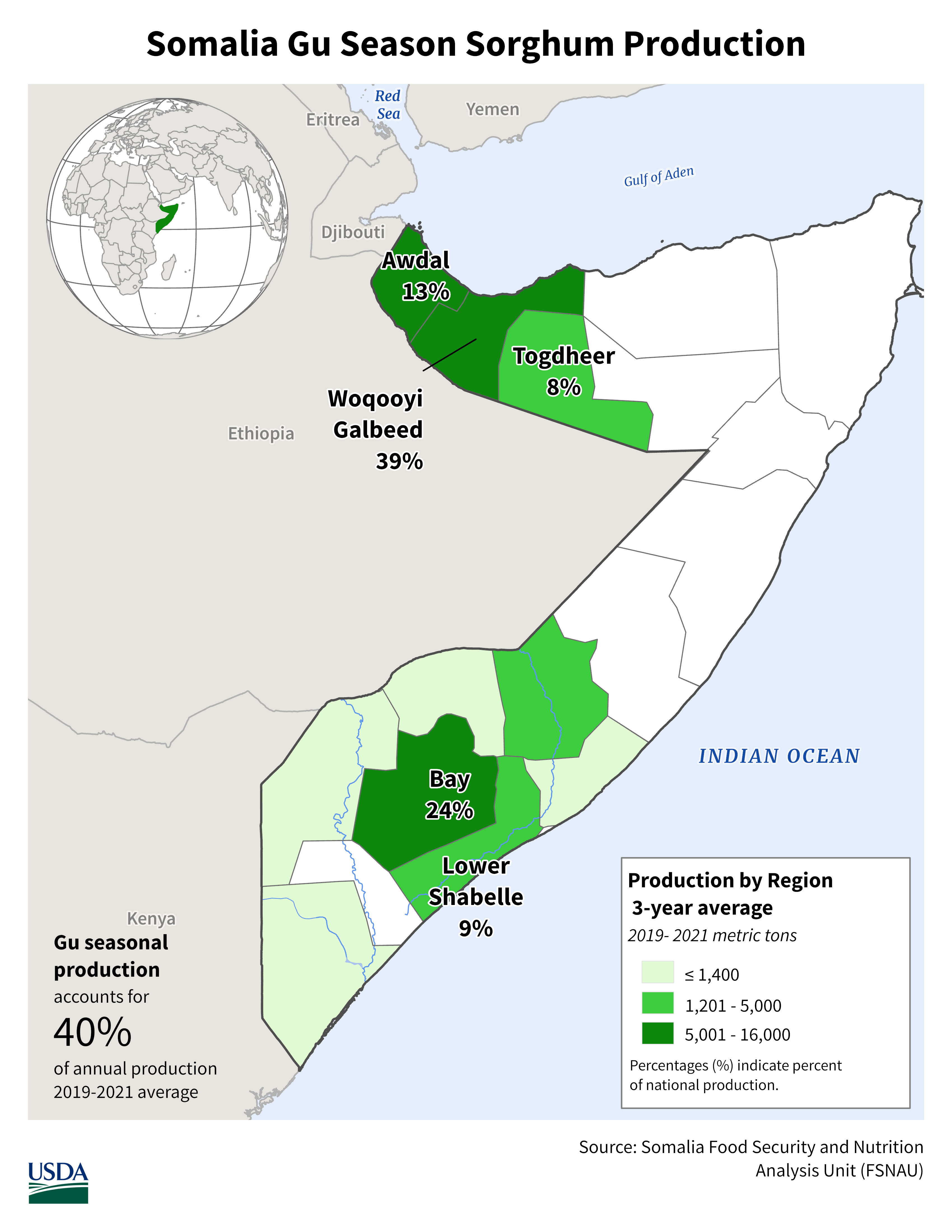
Gu Sorghum
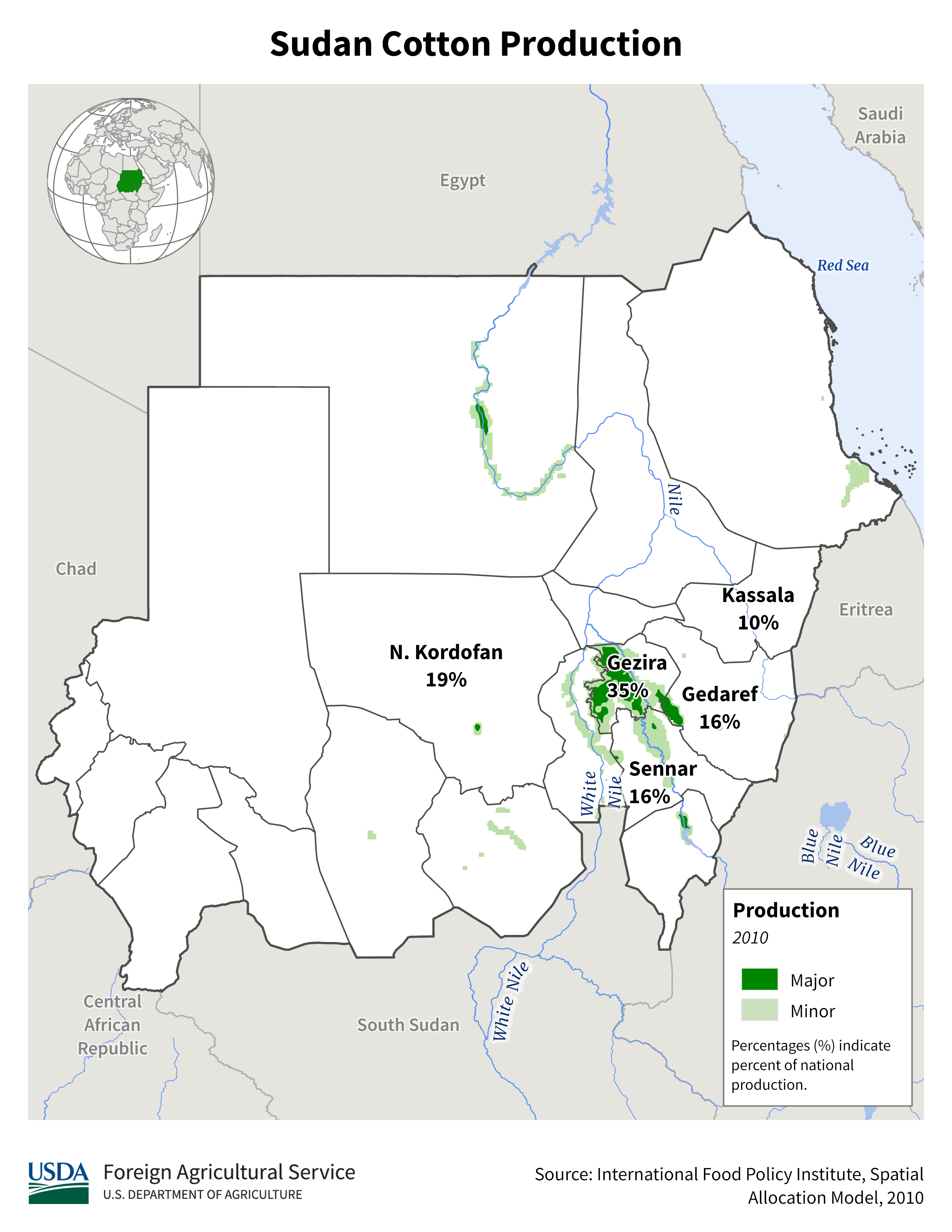
Cotton
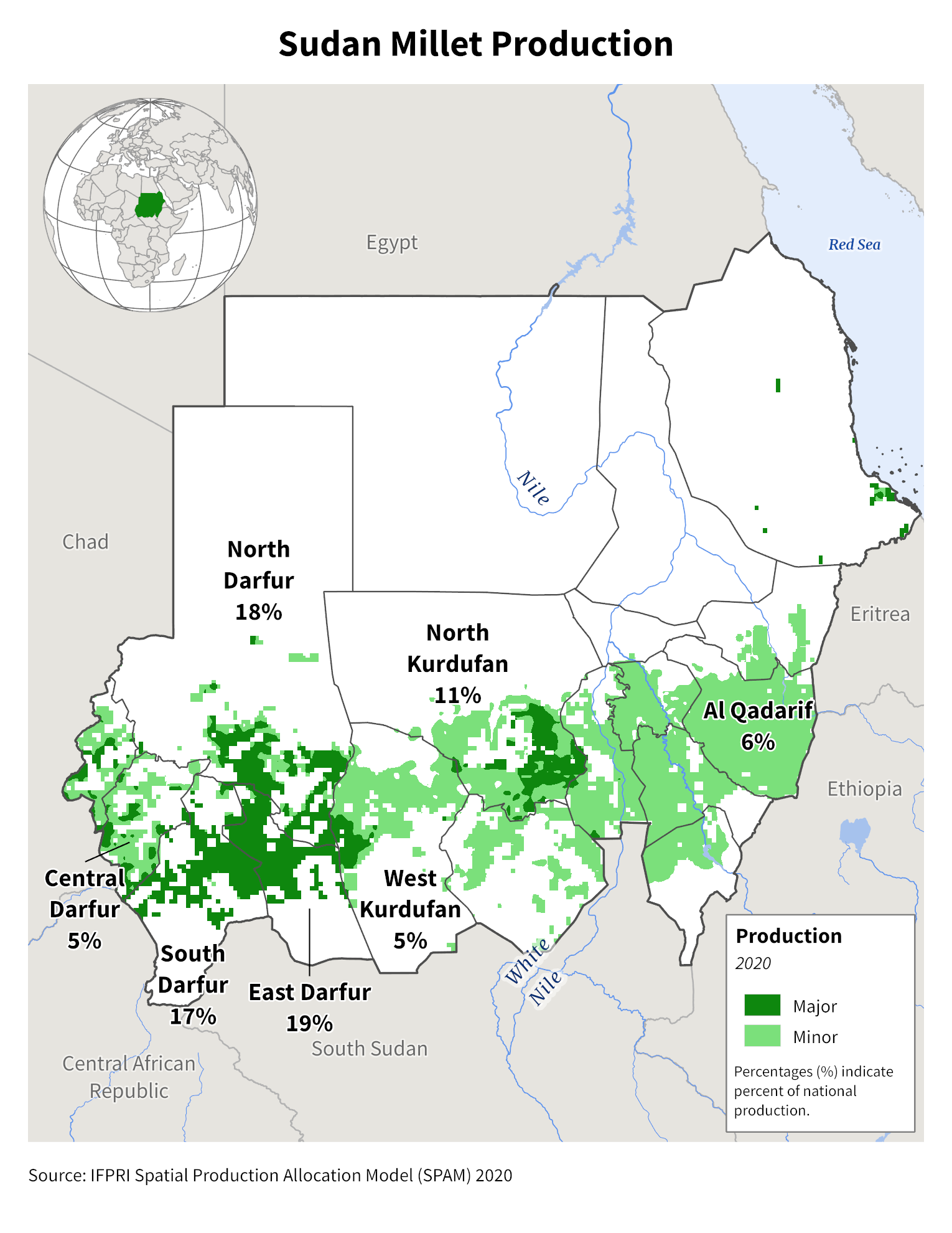
Millet
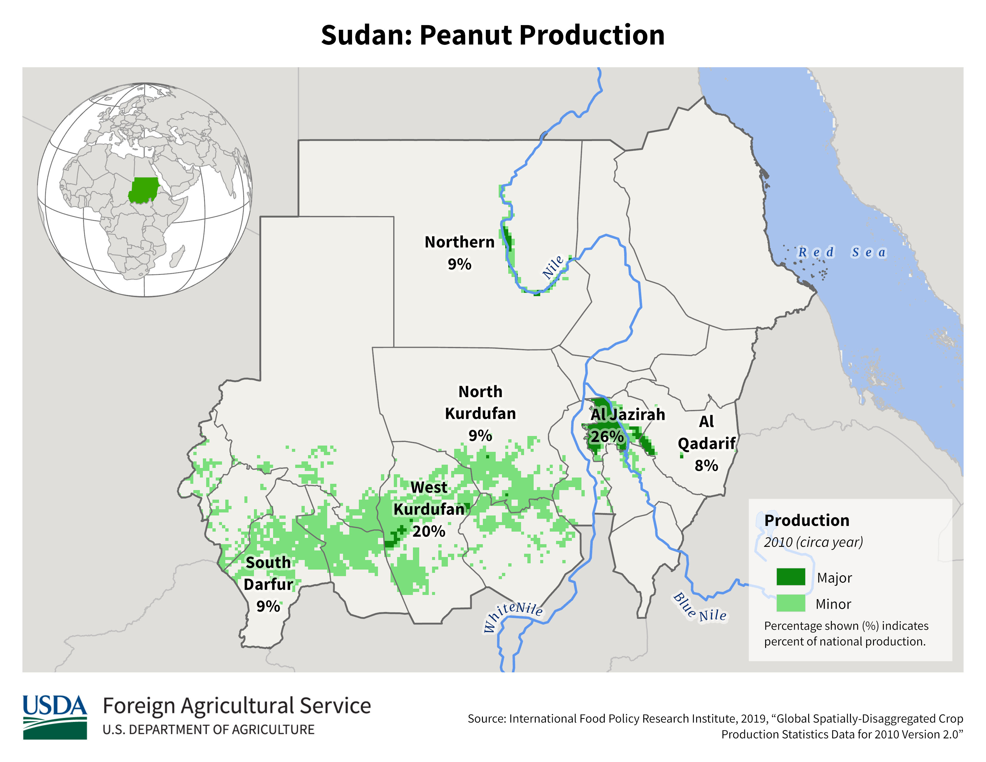
Peanut
Sorghum
Wheat
Millet
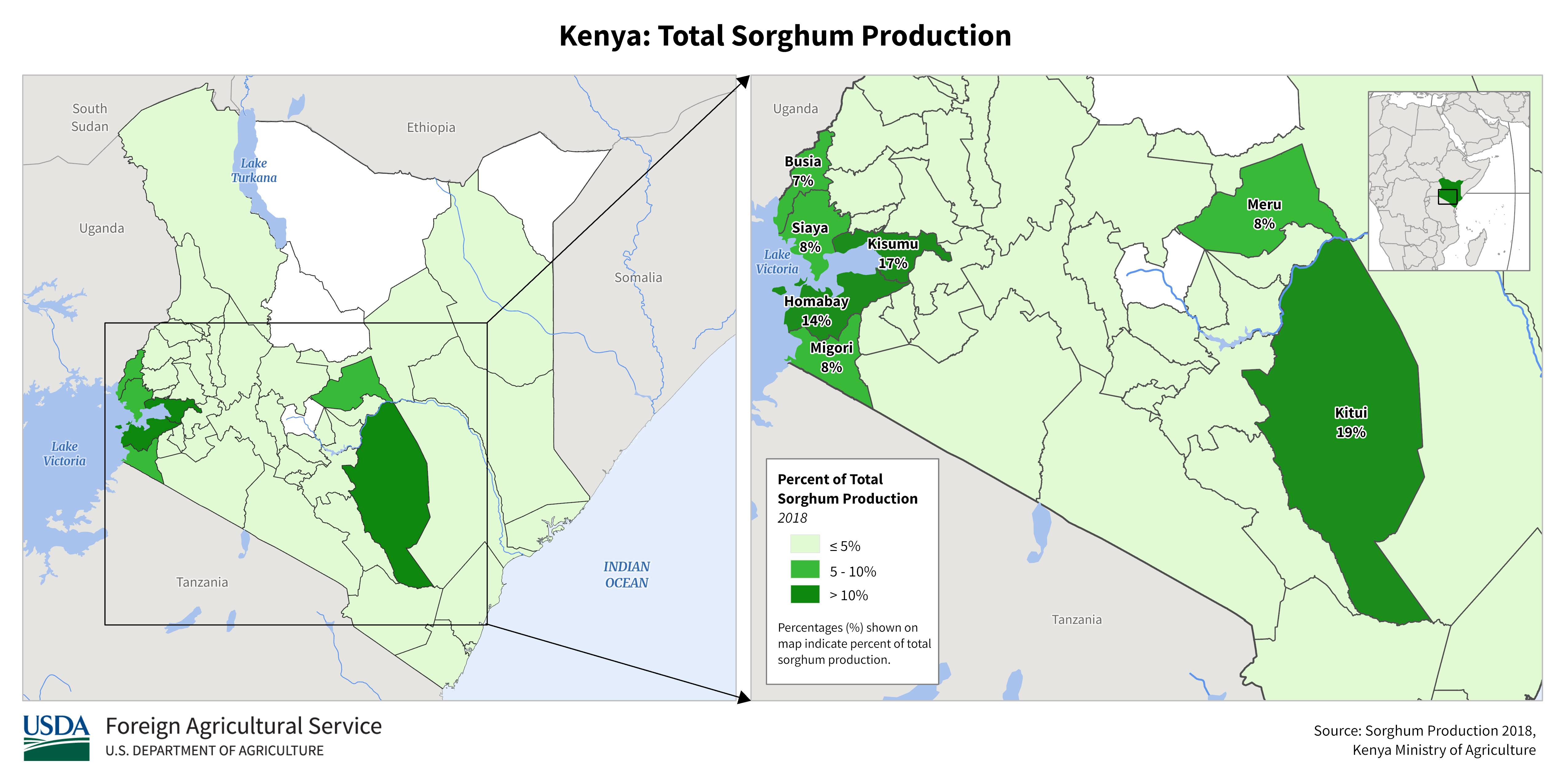
Sorghum
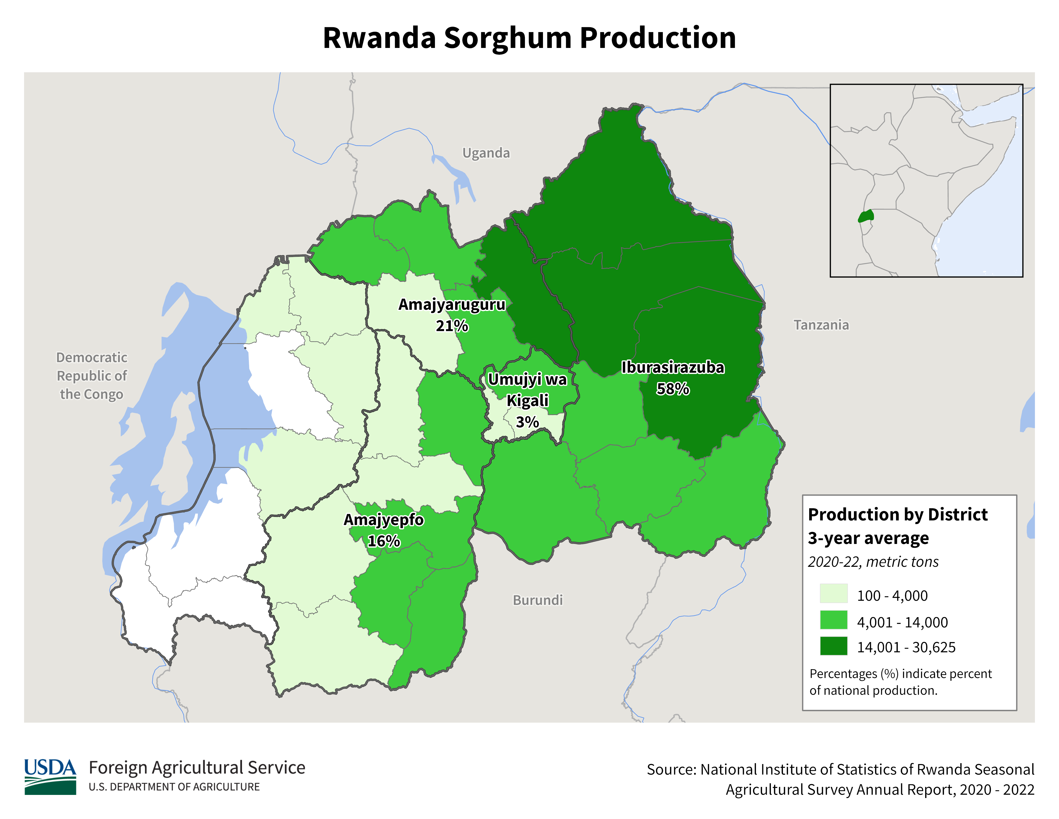
Sorghum
Sorghum
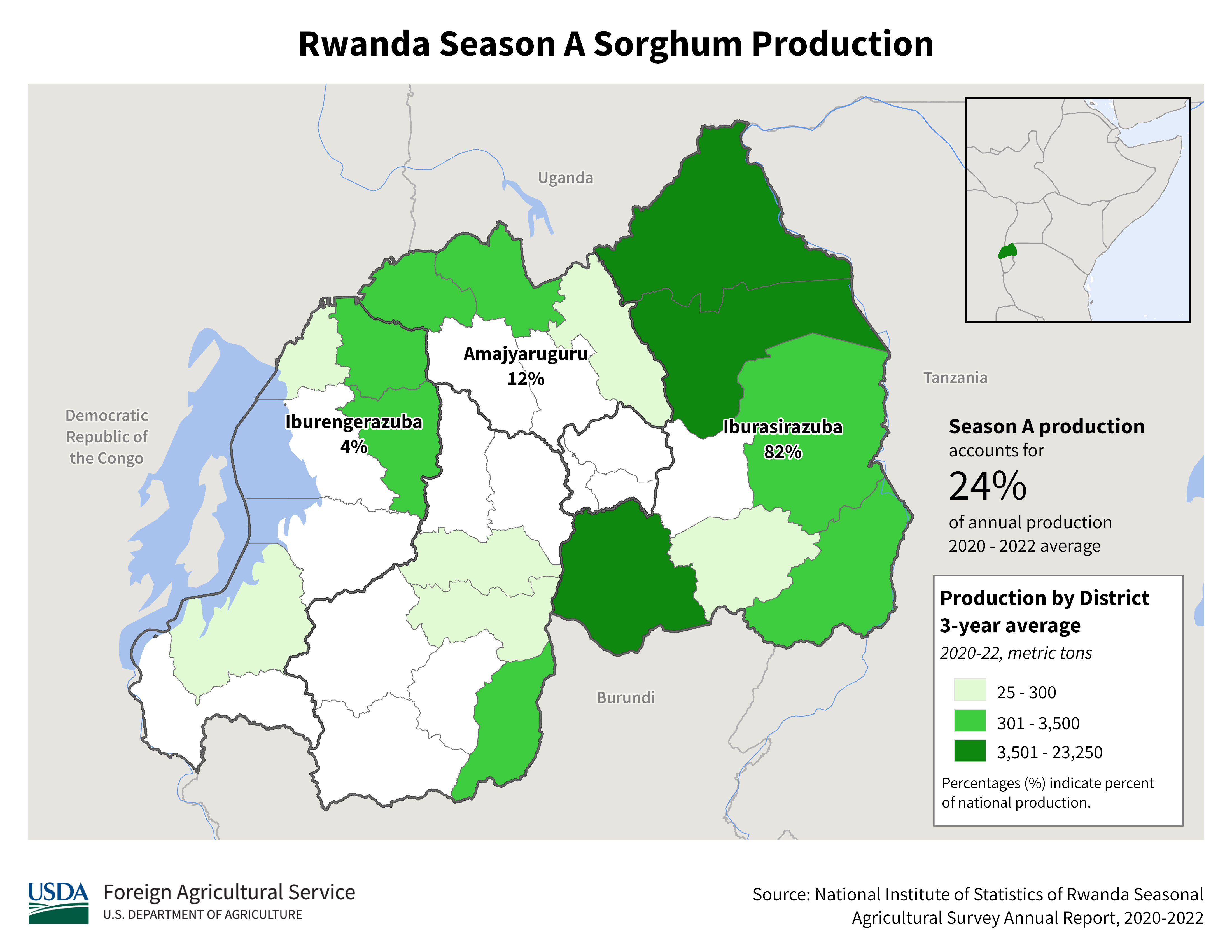
Season A
Sorghum
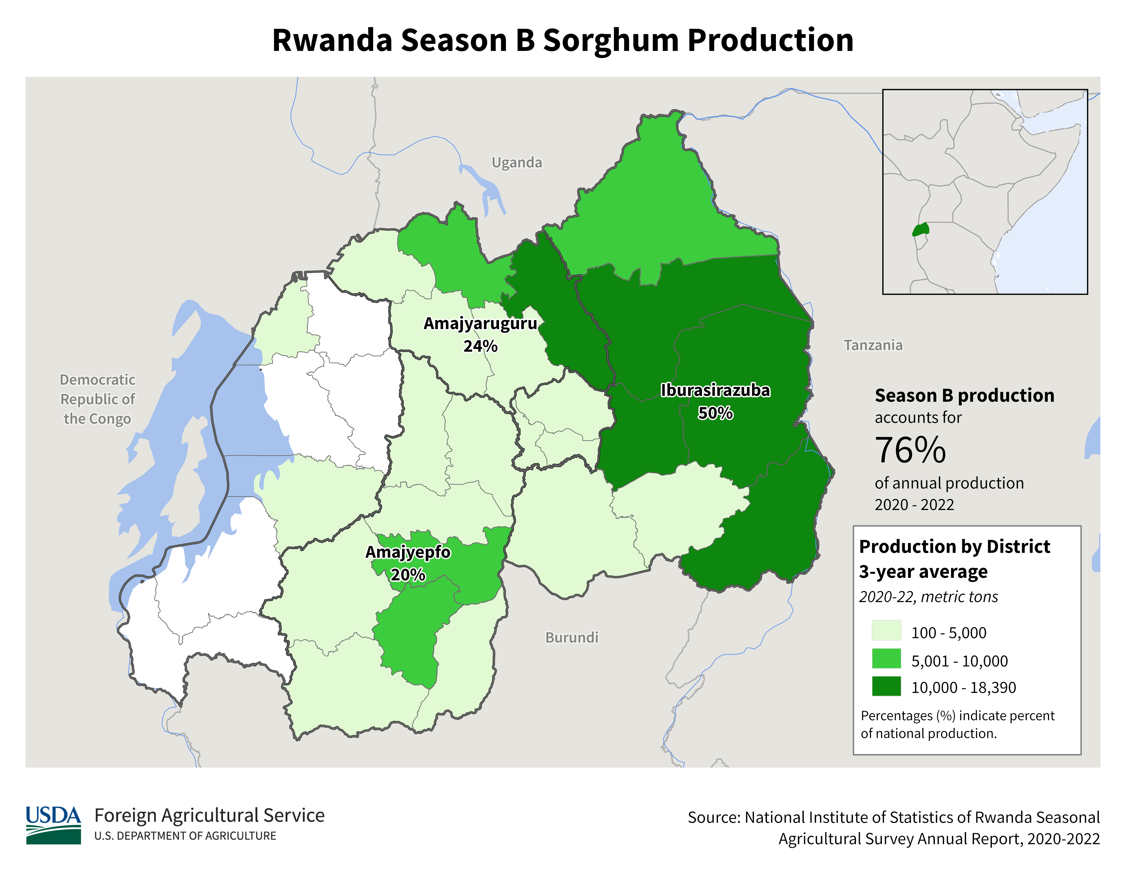
Season B
Corn
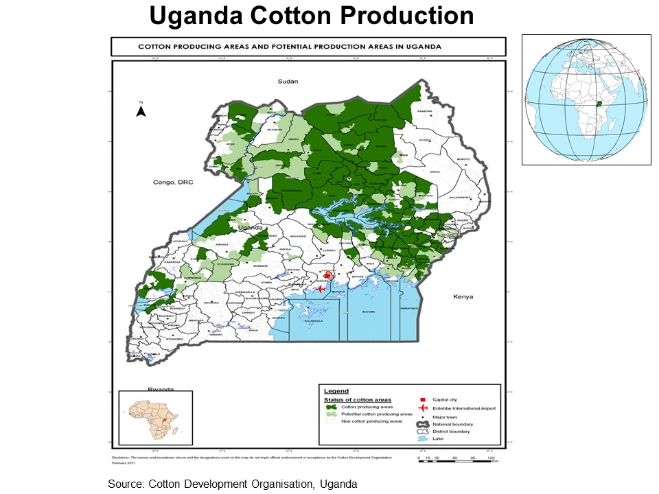
Cotton
Millet
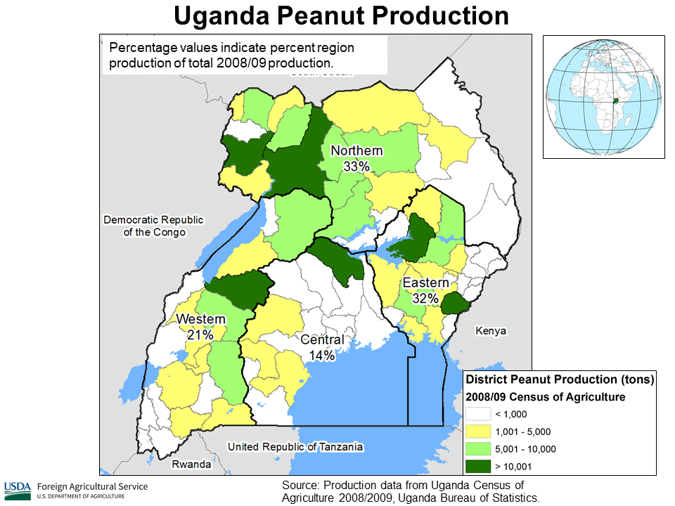
Peanut
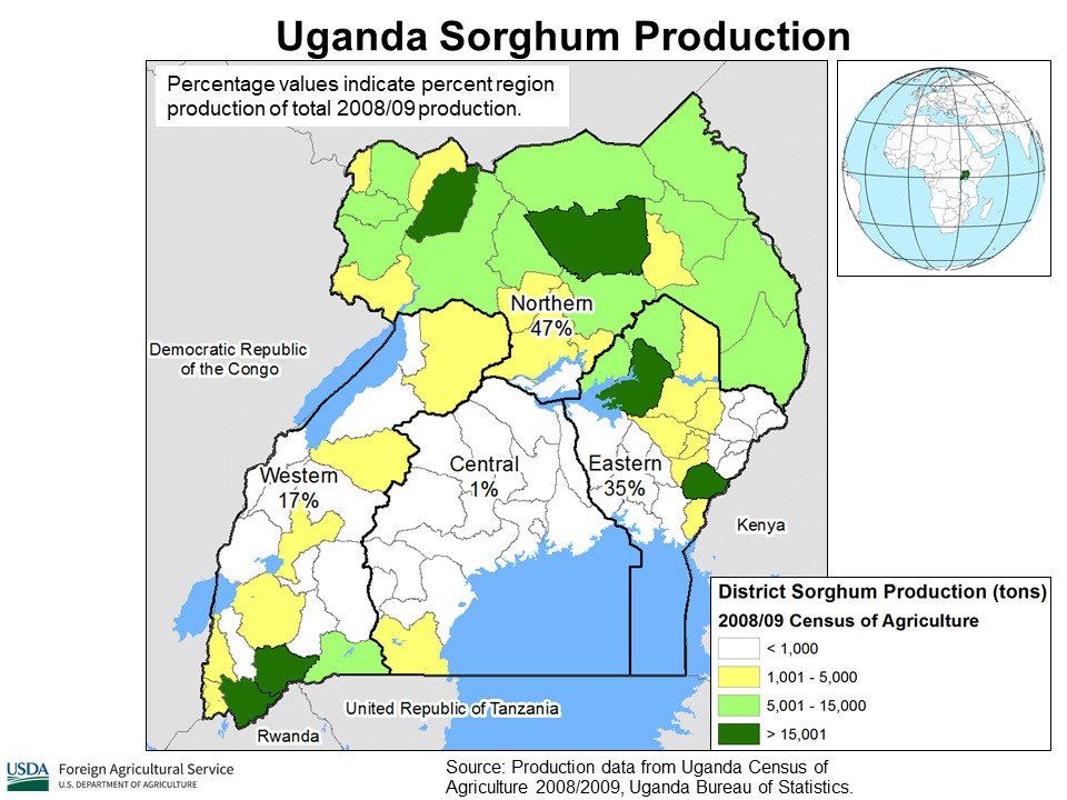
Sorghum
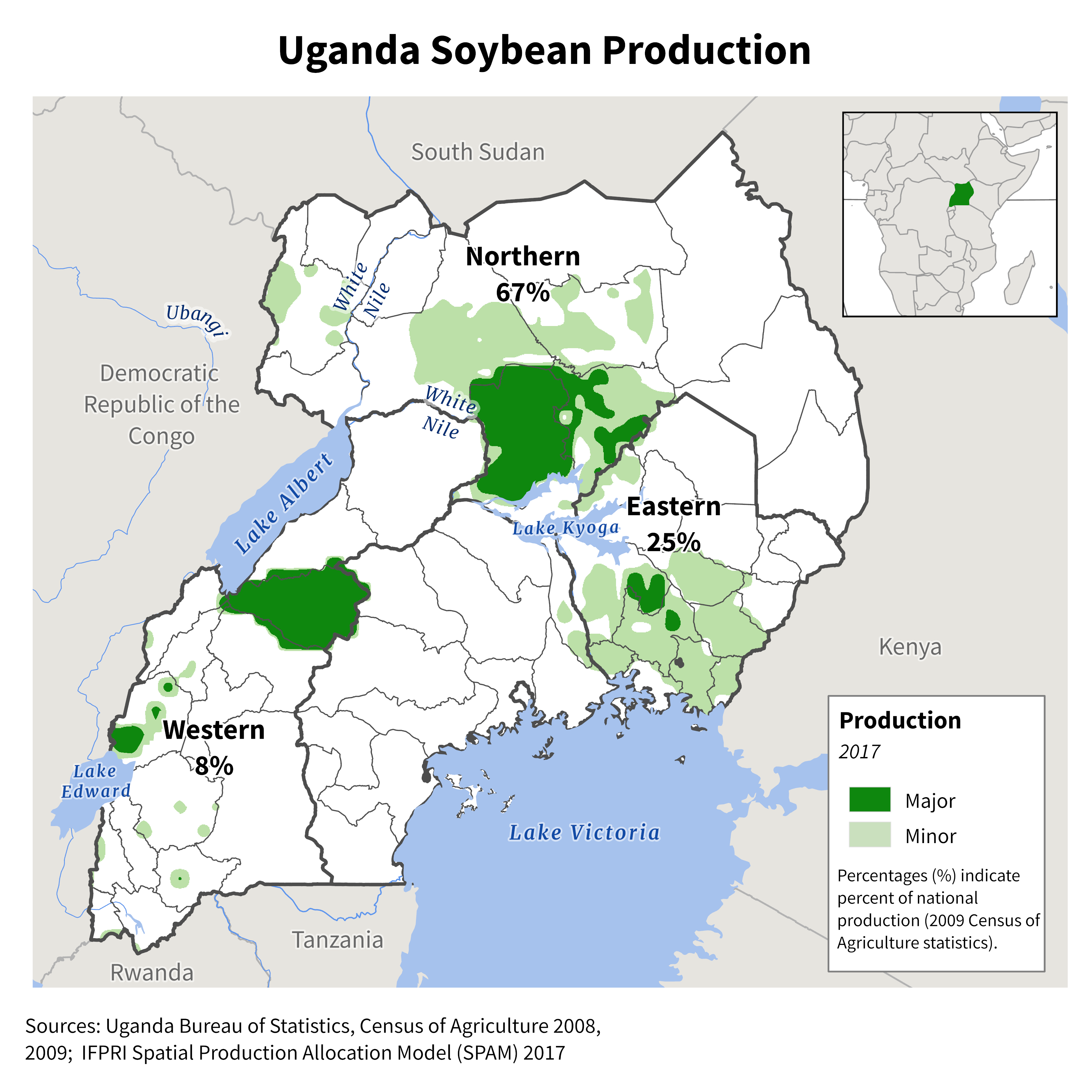
Soybean
Stay Connected
FAS on Twitter
Get Email Updates
FAS Home
USDA.gov
Economic Research Service
World Agricultural Outlook Board
Plain Writing
Trade Links
FOIA
Accessibility Statement
Privacy Policy
Non Discrimination Statement
Information Quality
USA.gov
White House